The Annex in New Haven in New Haven County, Connecticut — The American Northeast (New England)
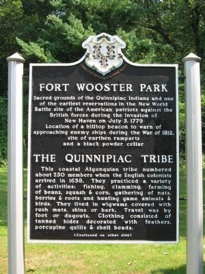
Fort Wooster Park
The Quinnipiac Tribe
Battle site of the American patriots against the British forces during the invasion of New Haven on July 5, 1779
Location of a hilltop beacon to warn of approaching enemy ships during the War of 1812, site of earthen ramparts and a black powder cellar
[ back ]
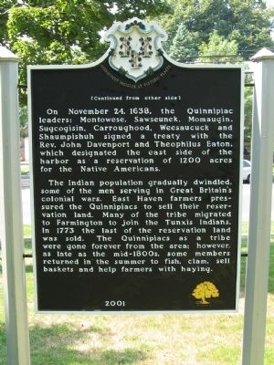
On November 24, 1638, the Quinnipiac leaders: Montowese, Sawseunek, Momaugin, Sugcogisin, Carroughood, Weesaucuck and Shaumpishuh signed a treaty with the Rev. John Davenport and Theophilus Eaton, which designated the east side of the harbor as a reservation of 1200 acres for the Native Americans.
The Indian population gradually dwindled, some of the men serving in Great Britain's colonial wars. East Haven farmers pressured the Quinnipiacs to sell their reservation land. Many of the tribe migrated to Farmington to join the Tunxis Indians. In 1773 the last of the reservation land was sold. The Quinnipiacs as a tribe were gone forever from the area; however, as late as the mid-1800s, some members returned in the summer to fish, clam, sell baskets and help farmers with haying.
2001
Erected 2001.
Topics. This historical marker is listed in these topic lists: Colonial Era • Native Americans • Settlements & Settlers • War, US Revolutionary. A significant historical date for this entry is July 5, 1779.
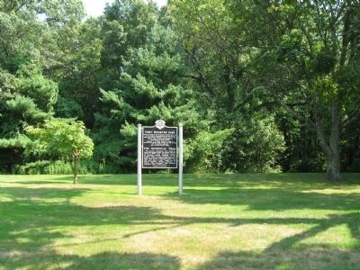
Location. 41° 16.93′ N, 72° 53.65′ W. Marker is in New Haven, Connecticut, in New Haven County. It is in The Annex. Marker is at the intersection of Townsend Avenue and Upson Terrace, on the left when traveling south on Townsend Avenue. Located in Fort Wooster Park. Touch for map. Marker is in this post office area: East Haven CT 06512, United States of America. Touch for directions.
Other nearby markers. At least 8 other markers are within walking distance of this marker. A Quinnipiac Indian (a few steps from this marker); Beacon Hill (about 400 feet away, measured in a direct line); East Shore Park (approx. 0.4 miles away); 32nd Ward World War I Memorial (approx. 0.8 miles away); Fort Nathan Hale (approx. 0.9 miles away); In Honor of Captain Nathan Hale (approx. 0.9 miles away); The Oyster Industry in New Haven (approx. 0.9 miles away); Society of The Cincinnati Memorial (approx. one mile away). Touch for a list and map of all markers in New Haven.
Regarding Fort Wooster Park. Located near Fort Nathan Hale on New Haven's Eastern Shore, Fort Wooster and its Memorial Park commands the heights of Beacon Hill where signal fires were once lit to warn inhabitants of impending dangers. The park features walking trails leading up to earthen works fortifications at the top of the hill.
As of 1820, Fort Wooster was an oval earthen redoubt on a height commanding 168 ft, at 2000 yards distance, over Fort Hale. Its circuit measured on the interior crest of the breastworks was 122 yards, its longer axis was 44 and its smaller 22 yards, measured on the inside. The breastwork is 15 feet thick and the entry was covered by a redan. The interior contained a powder magazine covered with a bombproof shed of beams. This earthwork was planned to be moderinzed as part of the Third System of fortifications mounting 12 guns.
Credits. This page was last revised on February 10, 2023. It was originally submitted on September 10, 2010, by Michael Herrick of Southbury, Connecticut. This page has been viewed 1,245 times since then and 24 times this year. Photos: 1, 2, 3. submitted on September 10, 2010, by Michael Herrick of Southbury, Connecticut.


