Beltsville in Prince George's County, Maryland — The American Northeast (Mid-Atlantic)
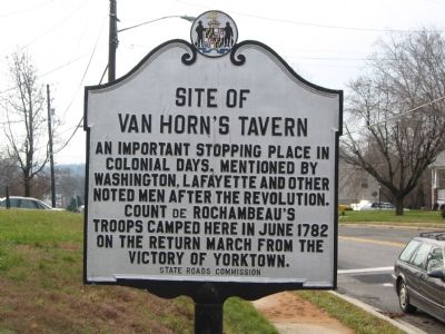
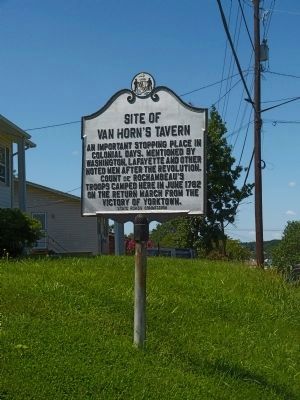
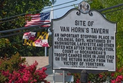
Site of Van Horn's Tavern
Erected by State Roads Commission.
Topics and series. This historical marker is listed in these topic lists: Industry & Commerce • War, US Revolutionary. In addition, it is included in the Former U.S. Presidents: #01 George Washington, and the The Washington-Rochambeau Route series lists. A significant historical month for this entry is June 1782.
Location. 39° 2.583′ N, 76° 53.741′ W. Marker is in Beltsville, Maryland, in Prince George's County. Marker is at the intersection of Old Baltimore Pike and Odell Road on Old Baltimore Pike. Touch for map. Marker is in this post office area: Beltsville MD 20705, United States of America. Touch for directions.
Other nearby markers. At least 8 other markers are within 2 miles of this marker, measured as the crow flies. Van Horn’s Tavern (approx. 0.7 miles away); Queen’s Chapel Methodist Church, Established 1868 (approx. 1˝ miles away); Ebenezer Meeting House (approx. 1˝ miles away); Iron Production: Maryland's Industrial Past / The Ironmaking Process (approx. 1.6 miles away); When the Iron was Hot: African American Ironworkers of Muirkirk (approx. 1.6 miles away); Abraham Hall: An African American Benevolent Lodge (approx. 1.6 miles away); Three Sisters: Close Knit Communities of the Laurel Area (approx. 1.6 miles away); Beltsville Agricultural Research Center - West (approx. 1.9 miles away). Touch for a list and map of all markers in Beltsville.
More about this marker. There is another marker, "Van Horn's Tavern" with an arrow, .7 miles southwest at intersection of Baltimore Avenue (US 1) and Prince George's Avenue.
Additional commentary.
1. History of Van Horn Tavern
The Wikipedia entry for Beltsville, MD tells the story this way:
"By 1730, Post Road (now part of US 1) was the main thoroughfare through Beltsville. Though crude, it made stagecoach travel possible. In 1783, Gabriel Peterson Van Horn established a stage line and built the Van Horn Tavern on Odell Road, where passengers could spend the night as they traveled between Baltimore and Washington. The trip took one and one-half days." Note To Editor only visible by Contributor and editor
— Submitted August 7, 2013, by Allen C. Browne of Silver Spring, Maryland.
Credits. This page was last revised on November 22, 2019. It was originally submitted on November 16, 2007, by F. Robby of Baltimore, Maryland. This page has been viewed 2,367 times since then and 51 times this year. Photos: 1. submitted on November 16, 2007, by F. Robby of Baltimore, Maryland. 2, 3. submitted on August 7, 2013, by Allen C. Browne of Silver Spring, Maryland.


