Near Middlesboro in Bell County, Kentucky — The American South (East South Central)
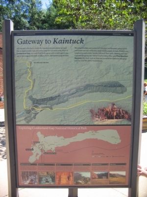
Gateway to Kaintuck
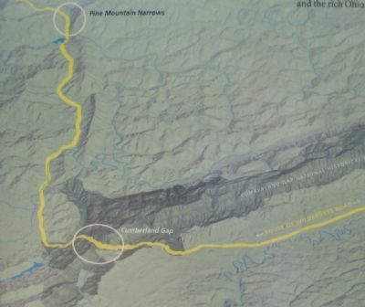
Woodland buffalo and parties of Cherokee and Shawnee passed north and south over this wilderness road for thousands of years. Frontier-era longhunters and settler families followed their trails, climbing up to the Gap and dropping into Yellow Creek's valley. Once past Pine Mountain Narrows, they were well on their way to reach the Kentucky bluegrass and the rich Ohio River bottomlands.
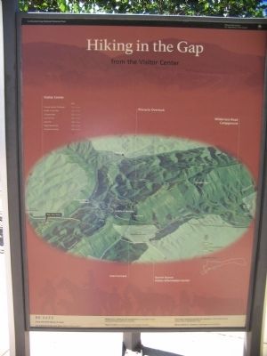
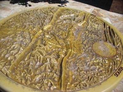
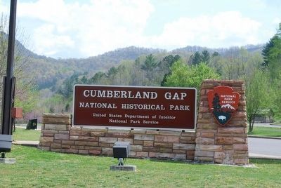
Exploring Cumberland Gap National Historical Park
Wilderness Road Trail 1
Walk in the footsteps of Dr. Walker, Daniel Boone, and 250,000 settlers on the newly restored Wilderness Road.
Iron Furnace 2
The shortest trail to the Gap begins at this reminder of 19th-century industry, found in the town of Cumberland Gap.
Gap Cave 3
Park rangers now take visitors on tours into this historic cave. Check at either visitor center for cave tour schedules.
Pinnacle Overlook 4
This easily accessible overlook offers dramatic vistas of the key passage through the Cumberland Mountains.
Hensley Settlement 5
Reminders of Appalachia's pioneer era can still be seen at Hensley Settlement. Ask a ranger about tour schedules.
White Rocks 6
A well-known landmark for early travelers bound west, these cliffs are a full day's walk from the Gap
Erected by Cumberland Gap National Historical Park - National Park Service - Department of the Interior.
Topics. This historical marker is listed in these topic lists: Natural Features • Settlements & Settlers.
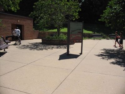
Location. 36° 36.163′ N, 83° 41.741′ W. Marker is near Middlesboro, Kentucky, in Bell County. Marker is on Pinnacle Road, on the right when traveling east. Located at the west end Cumberland Gap National Historical Park visitor center. Touch for map. Marker is in this post office area: Middlesboro KY 40965, United States of America. Touch for directions.
Other nearby markers. At least 8 other markers are within one mile of this marker, measured as the crow flies. Stories of a journey through the Wilderness, into Kentucke.. (within shouting distance of this marker); The Emigrant's Dream (about 300 feet away, measured in a direct line); Community Park to National Park (approx. 0.2 miles away); Pinnacle of Perfection (approx. 0.3 miles away); Lewis and Clark in Kentucky Cumberland Gap (approx. 0.4 miles away); Middlesboro Meteorite Crater Impact Site
(approx. 0.7 miles away); Wilderness Road (approx. 0.8 miles away); Warriors' Path (approx. one mile away). Touch for a list and map of all markers in Middlesboro.
More about this marker. This is one of the park's standard markers and is duplicated at several locations.
Also see . . . Cumberland Gap National Historical Park. (Submitted on September 18, 2010, by Craig Swain of Leesburg, Virginia.)
Credits. This page was last revised on August 30, 2022. It was originally submitted on September 18, 2010, by Craig Swain of Leesburg, Virginia. This page has been viewed 1,291 times since then and 27 times this year. Photos: 1, 2, 3, 4, 5. submitted on September 18, 2010, by Craig Swain of Leesburg, Virginia. 6, 7, 8. submitted on September 14, 2015, by Brandon Fletcher of Chattanooga, Tennessee.
