Grantsville in Garrett County, Maryland — The American Northeast (Mid-Atlantic)
Traveling the National Road
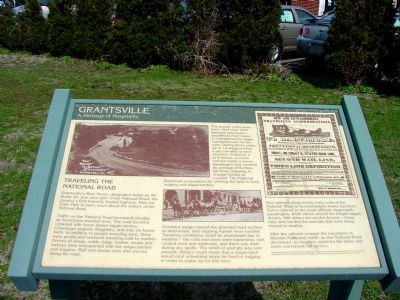
Grantsville
— A Heritage of Hospitality —
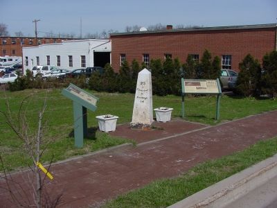
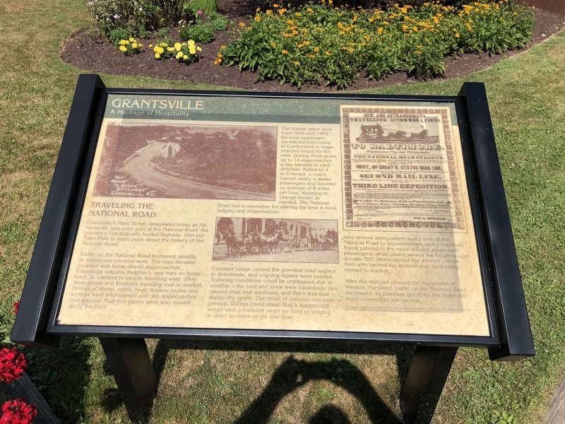
Granstville's Main Street, designated today as Alt. Route 40, was once part of the National Road, the country's first federally funded highway. Visit our Town Park to learn more about the history of the National Road.
Traffic on the National Road increased steadily as Americans traveled west. The road became crowded with horse-drawn stagecoaches, Conestoga wagons, freighters, and men on horseback. In addition to people travelling west, there were goods and livestock travelling east to market. Droves of sheep, cattle, hogs, horses, mules and turkeys were interspersed with the stagecoaches and wagons. Mail and slaves were also moved along the road.
The busiest years were from 1843 until 1852 when passengers transferred from trains in Cumberland to stagecoaches bound for the west. At that time, up to 14 stagecoaches a day traveled in each direction. Pulled by 4 to 6 horses, each coach carried about a dozen passengers. They traveled an average of 8 miles per hour, stopping to change horses as needed. The National Road had a reputation for offering the best in food, lodging and stagecoaches.
Constant usage caused the graveled road surface to deteriorate, and ongoing repairs were needed. Traveling conditions could be unpleasant due to weather - the cold and snow were hazardous, rain caused mud and washouts, and there was dust during dry spells. The smell of animals was ever present. Delays could mean that a stagecoach would omit scheduled stops for food or lodging in order to make up for lost time.
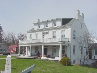
Inns sprang up along nearly every mile of the National Road to accommodate weary travelers. Some catered to the more affluent stagecoach passengers. Some served the freight wagon drivers. Still others served the drovers—those men who herded the animals that were being moved to market.
After the railroad crossed the mountains of Western Maryland, traffic on the National Road decreased, as travelers opted for the faster and more convenient rail service.
Erected by the Appalachian Regional Commission, Maryland Office of Planning, Town of Grantsville, Greater Grantsville Business Association, and Preservation Maryland/Maryland Historical Trust.
Topics and series. This historical marker is listed in these topic lists: Industry & Commerce • Political Subdivisions • Roads & Vehicles. In addition, it is included in the Maryland Historical Trust, and the The Historic National Road series lists. A significant historical year for this entry is 1843.
Location. 39° 41.754′ N, 79° 9.106′ W. Marker is in Grantsville, Maryland, in Garrett County. Marker is on Main Street (Alternate
Photographed By Devry Becker Jones (CC0), July 17, 2020
2. Traveling the National Road Marker
The marker has apparently suffered slight weather damage.
Other nearby markers. At least 8 other markers are within walking distance of this marker. Early Inns (here, next to this marker); Casselman Hotel (a few steps from this marker); Leo J. Beachy (approx. ¼ mile away); The National Road (approx. 0.3 miles away); Casselman River Bridge State Park (approx. 0.4 miles away); a different marker also named The National Road (approx. 0.4 miles away); Mountain Maryland Gateway to the West (approx. 0.4 miles away); “The Little Crossings” / Castleman’s River Bridge (approx. 0.4 miles away). Touch for a list and map of all markers in Grantsville.
Additional commentary.
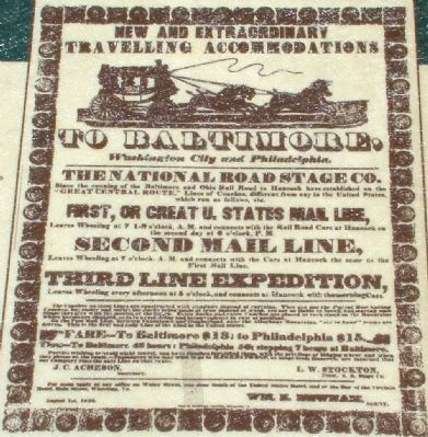
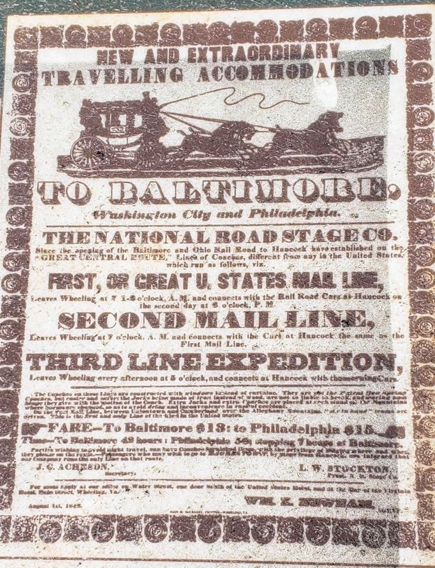
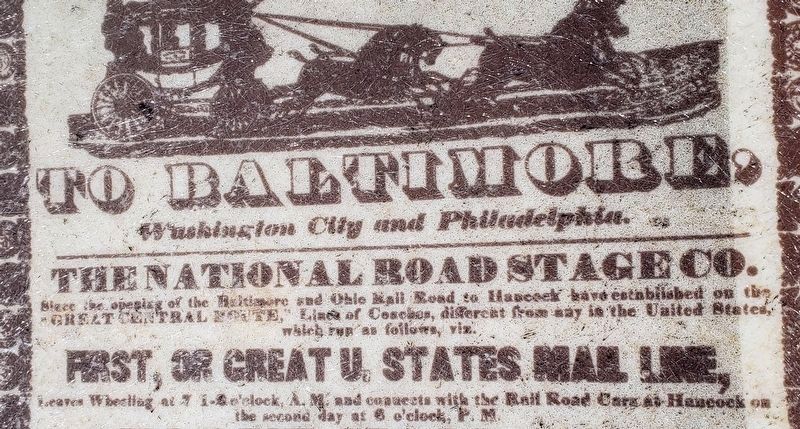
1. New and Extraordinary Travelling Accomodations to Baltimore, Washington City and Philadelphia.
(Transcription of the advertisement reproduced on the marker.)
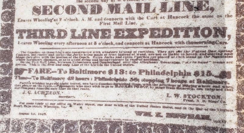
The National Road Stage Co. since the coming of the Baltimore and Ohio Rail Road to Hancock have established on the "Great Central Route," Lines of Coaches, different from any in the United States, which run as follows, vix. • First, or Great U. States Mail Line, leaves Wheeling at 7 1-2 o'clock, A.M. and connects with the Rail Road Cars at Hancock on the second day at 6 o'clock P.M. • Second Mail Line, leaves Wheeling at 7 o'clock, A.M. and connects with the Cars at Hancock the same as the First Mail Line. • Third Line Expedition, leaves Wheeling every afternoon at 5 o'clock, and connects at Hancock with the morning Cars.
The coaches on these Lines are constructed with windows instead of curtains. They are not the Patent Bon Spring Coaches, but easier and safer: the Jacks being made of iron instead of wood, are not so liable to break, and bearing on hinge they give with the movement of the Coach. Extra Jacks and extra Coaches are placed at each stand on the Mountains where horses are changed, so as to avoid delay and inconvenience in case of accident. • On the Fast Mail Line, between Uniontown and Cumberland over the Allegheny Mountains, "mix in hand" teams are driven. This is the first and only Line of the kind in the United States.
Fare to Baltimore $18; to Philadelphia $15. Time to Baltimore 49 hours; Philadelphia 56, stopping 7 hours at Baltimore.
Parties wishing to avoid night travel can have Coaches furnished them, with the privilege of alighting where and when they please on the route. —Passengers who may wish to go to Hagerstown, by stage from Hancock, are informed that our Company runs the only Line on that route.
J.C. ACHESON, Secretary. L. W. STOCKTON, Prest. N. R. Stage Co.
For seats
apply at our office on Water Street, one door south of the United States Hotel, and at the Bar of the Virginia Hotel, Wheeling, VA.
August 1st, 1842. WM. K. NEWNAM, Agent.
— Submitted May 18, 2006, by J. J. Prats of Powell, Ohio.
Credits. This page was last revised on December 10, 2021. It was originally submitted on May 18, 2006, by J. J. Prats of Powell, Ohio. This page has been viewed 2,840 times since then and 42 times this year. Last updated on July 25, 2021, by Bradley Owen of Morgantown, West Virginia. Photos: 1. submitted on May 18, 2006, by J. J. Prats of Powell, Ohio. 2. submitted on July 19, 2020, by Devry Becker Jones of Washington, District of Columbia. 3. submitted on May 18, 2006, by J. J. Prats of Powell, Ohio. 4. submitted on May 19, 2006, by J. J. Prats of Powell, Ohio. 5. submitted on May 18, 2006, by J. J. Prats of Powell, Ohio. 6, 7, 8. submitted on July 25, 2021, by Bradley Owen of Morgantown, West Virginia. • Bill Pfingsten was the editor who published this page.
