Near La Marque in Galveston County, Texas — The American South (West South Central)
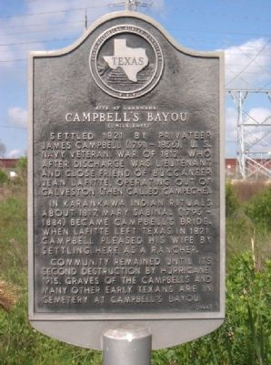
Campbell's Bayou
Site Of Landmark
— (1 mile East) —
In Karankawa Indian rituals about 1817, Mary Sabinal (1795-1884) became Campbell's bride. When Lafitte left Texas in 1821, Campbell pleased his wife by settling here as a rancher.
Community remained until its second destruction by hurricane, 1915. Graves of the Campbells and many other early Texans are in cemetery at Campbell's Bayou.
Erected 1968 by State Historical Survey Committee. (Marker Number 267.)
Topics. This historical marker is listed in this topic list: Settlements & Settlers. A significant historical year for this entry is 1821.
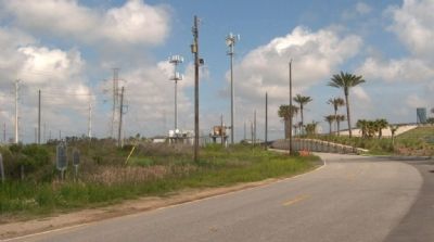
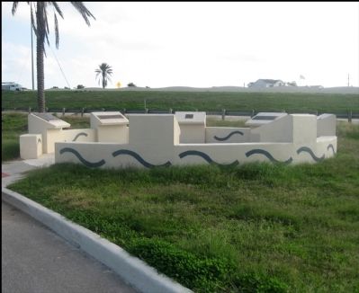
Location. 29° 18.247′ N, 94° 54.117′ W. Marker is near La Marque, Texas, in Galveston County. Marker is on Interstate 45 Frontage Road, on the left when traveling south. At the north end of the highway causeway (bridge) to Galveston Island, on the east frontage road. Touch for map. Marker is in this post office area: La Marque TX 77568, United States of America. Touch for directions.
Other nearby markers. At least 8 other markers are within 5 miles of this marker, measured as the crow flies. The Galveston Daily News (approx. 2.6 miles away); Galveston "News", C.S.A. (approx. 2.6 miles away); Site of Magnolia Grove Cemetery (approx. 3.8 miles away); Valentine T. Dalton (approx. 4.8 miles away); The Italian Vault (approx. 4.8 miles away); Greek Orthodox Cemetery (approx. 4.9 miles away); Rosewood Cemetery (approx. 5 miles away); a different marker also named Rosewood Cemetery (approx. 5.1 miles away).
Credits. This page was last revised on September 14, 2020. It was originally submitted on September 19, 2010, by Gregory Walker of La Grange, Texas. This page has been viewed 1,311 times since then and 65 times this year. Photos: 1, 2. submitted on September 19, 2010, by Gregory Walker of La Grange, Texas. 3. submitted on November 29, 2011, by Jim Evans of Houston, Texas. • Bill Pfingsten was the editor who published this page.


