Gate City in Scott County, Virginia — The American South (Mid-Atlantic)
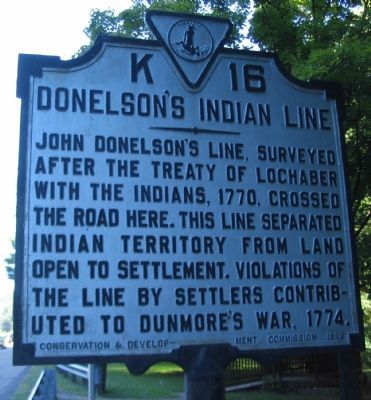
Donelson's Indian Line
Erected 1932 by Conservation & Development Commission. (Marker Number K-16.)
Topics and series. This historical marker is listed in these topic lists: Colonial Era • Native Americans • Settlements & Settlers. In addition, it is included in the Virginia Department of Historic Resources (DHR) series list. A significant historical year for this entry is 1770.
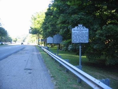
Location. 36° 38.092′ N, 82° 33.309′ W. Marker is in Gate City, Virginia, in Scott County. Marker is on Main Street (U.S. 23/58), on the right when traveling west. Located at a pull off at the entrance to Gate City. One of five markers in this cluster. Touch for map. Marker is in this post office area: Gate City VA 24251, United States of America. Touch for directions.
Other nearby markers. At least 8 other markers are within walking distance of this marker. Big Moccasin Gap (here, next to this marker); First Court of Scott County (a few steps from this marker); McConnell's Birthplace (a few steps from this marker); a different marker also named First Court of Scott County (approx. ¼ mile away); Carter Musical Family (approx. 0.4 miles away); John P. McConnell (approx. 0.4 miles away); Moccasin Gap (approx. 0.4 miles away); a different marker also named First Court of Scott County (approx. 0.4 miles away). Touch for a list and map of all markers in Gate City.
Related markers. Click here for a list of markers that are related to this marker. It lists two markers on Donelson’s Indian Line. Use the mapping feature to see both on the same map.
Credits. This page was last revised on March 30, 2021. It was originally submitted on September 20, 2010, by Craig Swain of Leesburg, Virginia. This page has been viewed 1,185 times since then and 43 times this year. Photos: 1, 2. submitted on September 20, 2010, by Craig Swain of Leesburg, Virginia.

