Midlothian in Chesterfield County, Virginia — The American South (Mid-Atlantic)
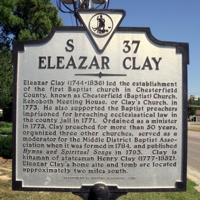
Eleazar Clay
Erected 2002 by Department of Historic Resources. (Marker Number S-37.)
Topics and series. This historical marker is listed in these topic lists: Cemeteries & Burial Sites • Churches & Religion. In addition, it is included in the Virginia Department of Historic Resources (DHR) series list. A significant historical year for this entry is 1773.
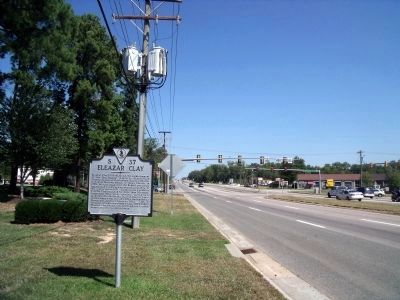
Location. 37° 26.031′ N, 77° 36.638′ W. Marker is in Midlothian, Virginia, in Chesterfield County. Marker is at the intersection of Hull Street Road (U.S. 360) and North Bailey Bridge Road, on the right when traveling west on Hull Street Road. Touch for map. Marker is in this post office area: Midlothian VA 23112, United States of America. Touch for directions.
Other nearby markers. At least 8 other markers are within 5 miles of this marker, measured as the crow flies. Dividends for the Future (approx. 3.6 miles away); Mid-Lothian Mines and Rail Roads (approx. 4.2 miles away); a different marker also named Mid-Lothian Mines and Rail Roads (approx. 4.3 miles away); a different marker also named Mid-Lothian Mines and Rail Roads (approx. 4.3 miles away); a different marker also named Mid-Lothian Mines and Rail Roads (approx. 4.4 miles away); a different marker also named Mid-Lothian Mines and Rail Roads (approx. 4.6 miles away); Headstock (approx. 4.6 miles away); The Bermuda Hundred Campaign (approx. 4.6 miles away). Touch for a list and map of all markers in Midlothian.
Credits. This page was last revised on January 13, 2022. It was originally submitted on September 21, 2010, by Bernard Fisher of Richmond, Virginia. This page has been viewed 1,549 times since then and 90 times this year. Photos: 1, 2. submitted on September 21, 2010, by Bernard Fisher of Richmond, Virginia.

