Near Spotsylvania Courthouse in Spotsylvania County, Virginia — The American South (Mid-Atlantic)
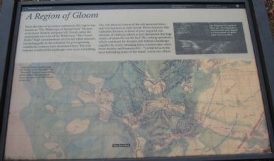
A Region of Gloom
The Battle of Chancellorsville
— Fredericksburg and Spotsylvania National Military Park —
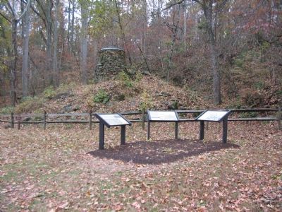
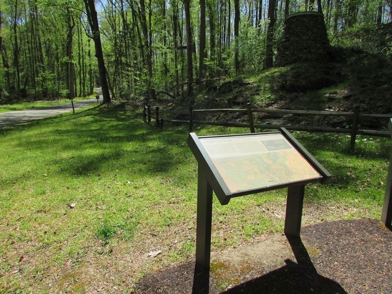
From the time of its earliest settlement, this region was known as "The Wilderness of Spotsylvania" because of its dense thickets and poor soil. Locals called the countryside just west of the Wilderness "The Poison Fields." High concentrations of iron and other minerals (including gold) in the soil made for poor growing conditions, scrawny trees dominated here. The iron industry rendered the landscape even more forbidding. The rich mineral content of the soil spawned mines and iron furnaces as early as 1718. Those furnaces (like Catharine Furnace, in front of you) required vast amounts of charcoal, which in turn demanded that huge swaths of timber be cut for fuel. The cutting operations which continued for decades, left behind a landscape engulfed by newly emerging pines, stunted oaks, vines, thorn bushes, and honeysuckle -- "a wilderness in the most forbidding sense of the word," wrote one officer.
Erected by National Park Service, U.S. Department of the Interior.
Topics. This historical marker is listed in these topic lists: Industry & Commerce • Natural Features • War, US Civil. A significant historical year for this entry is 1718.
Location. 38° 17.334′ N, 77° 38.881′ W. Marker is near Spotsylvania Courthouse, Virginia, in Spotsylvania County. Marker is at the intersection of Jackson Trail East and Sickles Drive, on the right when traveling south on Jackson Trail East. Located at stop six of the driving tour of Chancellorsville Battlefield. Jackson Trail East is an unpaved road approximating the path of General Jackson's flank march on May 2, 1863. Touch for map. Marker is at or near this postal address: 11699 Jackson Trail E, Spotsylvania VA 22553, United States of America. Touch for directions.
Other nearby markers. At least 8 other markers are within walking distance of this marker. Catharine Furnace (here, next to this marker); Jackson's Flank March (a few steps from this marker); Chancellorsville Campaign (approx. 0.2 miles away); About a mile in the distance... (approx. half a mile away); Birthplace of Matthew Fontaine Maury (1806-1873) (approx. half a mile away); Maury Birthplace (approx. half a mile away); a different marker also named Chancellorsville Campaign (approx. half a mile away); Maury House Trail (approx. 0.6 miles away). Touch for a list and map of all markers in Spotsylvania Courthouse.
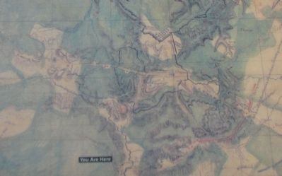
More about this marker. The lower portion of the marker displays a map of the region. "Catharine Furnace appears near the bottom of this map, drawn by "Stonewall" Jackson's topographer, Jed Hotchkiss. The map clearly shows the extend of the Wilderness's forest cover." On the upper right is a photograph of "The Wilderness as it appeared about 1900, 'It is impossible to conceive a

Photographed By Craig Swain, November 10, 2007
2. Detail of the Hotchkiss Map
Federal positions and entrenchments are outlined with the bold black lines surrounding Chancellorsville in the center. Red lines indicate Confederate positions. Areas wooded or covered by thickets at the time of the battle are colored green on the map.
Regarding A Region of Gloom. This is one of several markers for the Battle of Chancellorsville along McLaws Drive, Furnace Road, Sickles Drive, and East Jackson Trail, on the east side of the battlefield. See the McLaws's Line to Catharine Furnace Virtual Tour by Markers in the links section for a listing of related markers on the tour.
Also see . . .
1. Battle of Chancellorsville. National Parks Service site. (Submitted on November 17, 2007, by Craig Swain of Leesburg, Virginia.)
2. McLaws's Line to Catharine Furnace Virtual Tour by Markers. Spread across a two mile segment on the east side of the battlefield, this virtual tour by markers covers action from May 1-3, 1863. (Submitted on November 17, 2007, by Craig Swain of Leesburg, Virginia.)
Credits. This page was last revised on April 25, 2023. It was originally submitted on November 17, 2007, by Craig Swain of Leesburg, Virginia. This page has been viewed 1,443 times since then and 11 times this year. Photos: 1, 2, 3. submitted on November 17, 2007, by Craig Swain of Leesburg, Virginia. 4. submitted on April 24, 2023, by Bill Coughlin of Woodland Park, New Jersey.


