Russellville in Logan County, Kentucky — The American South (East South Central)
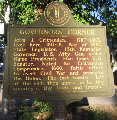
Governors' Corner
Erected 1964 by Kentucky Historical Society - Kentucky Department of Highways. (Marker Number 657.)
Topics and series. This historical marker is listed in these topic lists: Government & Politics • War, US Civil. In addition, it is included in the Kentucky Historical Society series list. A significant historical year for this entry is 1812.
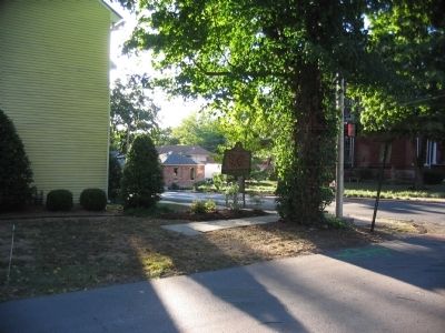
Location. 36° 50.451′ N, 86° 53.148′ W. Marker is in Russellville, Kentucky, in Logan County. Marker is at the intersection of West 9th Street (U.S. 79) and South Main Street (U.S. 431), on the right when traveling east on West 9th Street. Touch for map. Marker is at or near this postal address: 113 West 9th Street, Russellville KY 42276, United States of America. Touch for directions.
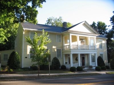
Other nearby markers. At least 8 other markers are within walking distance of this marker. O'Bannon House (a few steps from this marker); Townhouse of Maj. Richard Bibb (about 600 feet away, measured in a direct line); Rhea Stadium (about 700 feet away); Ken Barrett Field (about 700 feet away); United Methodist Temple (about 700 feet away); Old Bank, Robbed 1868 (approx. 0.2 miles away); a different marker also named Governor's Corner (approx. ¼ mile away); 6 Pdr Field Cannon (approx. 0.3 miles away). Touch for a list and map of all markers in Russellville.
Also see . . . John J. Crittenden. Wikipedia biography. (Submitted on September 23, 2010, by Craig Swain of Leesburg, Virginia.)

Photographed By Allen C. Browne, August 9, 2015
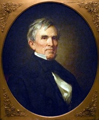
4. John J. Crittenden
This 1857 portrait of John J. Crittenden by George Peter Alexander Healy hangs in the National Portrait Gallery in Washington DC.
“During the campaign of 1860, many southerners declared that Abraham Lincoln's election to the presidency would give them no choice but to secede from the Union. One notable exception was Kentucky senator John Crittenden. This passionate advocate of national unity undertook the task of reaching an accommodation designed to derail the secession movement of 1861. Central to his plan was a proposal that would have permanently guaranteed the rights of slaveholders below the nation's 36°30' parallel. By now, however, bitterness over the slavery question ran too deeply, and neither North nor South could accept this conciliating measure. Instead, Crittenden had to content himself with ensuring that his own Kentucky did not secede; it was largely through his exertions that this state remained loyal to the Union after most of the South had left. ” — National Portrait Gallery
“During the campaign of 1860, many southerners declared that Abraham Lincoln's election to the presidency would give them no choice but to secede from the Union. One notable exception was Kentucky senator John Crittenden. This passionate advocate of national unity undertook the task of reaching an accommodation designed to derail the secession movement of 1861. Central to his plan was a proposal that would have permanently guaranteed the rights of slaveholders below the nation's 36°30' parallel. By now, however, bitterness over the slavery question ran too deeply, and neither North nor South could accept this conciliating measure. Instead, Crittenden had to content himself with ensuring that his own Kentucky did not secede; it was largely through his exertions that this state remained loyal to the Union after most of the South had left. ” — National Portrait Gallery
Credits. This page was last revised on August 21, 2018. It was originally submitted on September 23, 2010, by Craig Swain of Leesburg, Virginia. This page has been viewed 1,253 times since then and 33 times this year. Photos: 1, 2, 3. submitted on September 23, 2010, by Craig Swain of Leesburg, Virginia. 4. submitted on September 6, 2015, by Allen C. Browne of Silver Spring, Maryland.


