Near West Lafayette in Tippecanoe County, Indiana — The American Midwest (Great Lakes)
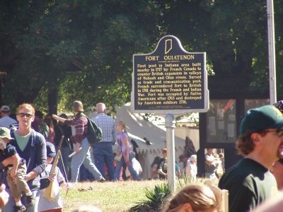
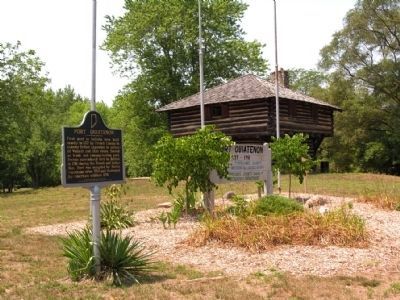
Fort Ouiatenon
Inscription.
First post in Indiana area built nearby in 1717 by French Canada to counter British expansion in valleys of Wabash and Ohio rivers. Served as trade and communication post. French surrendered fort to British in 1761 during the French and Indian War. Fort was occupied by Native Americans after 1763 and destroyed by American soldiers 1791.
Erected 1976 by Indiana Bicentennial Commission. (Marker Number 79.1998.2.)
Topics and series. This historical marker is listed in these topic lists: Forts and Castles • Military • Native Americans • Notable Events. In addition, it is included in the Indian Wars Battlefield Trails, the Indiana Historical Bureau Markers, and the The Spirit of ’76, America’s Bicentennial Celebration series lists. A significant historical year for this entry is 1717.
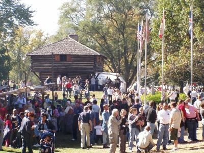
Location. 40° 24.387′ N, 86° 57.797′ W. Marker is near West Lafayette, Indiana, in Tippecanoe County. Marker can be reached from South River Road west of South Newman Road (County Road 300). It is located near the Blockhouse in Fort Ouiatenon Park. Touch for map. Marker is at or near this postal address: 3129 S River Rd, West Lafayette IN 47906, United States of America. Touch for directions.
Other nearby markers. At least 8 other markers are within 4 miles of this marker, measured as the crow flies. Site of the Birth Place of Rev. Anthony Foucher (within shouting distance of this marker); Liberty Tree (about 300 feet away, measured in a direct line); Post Ouiatenon Site (about 500 feet away); Universal Soil Loss Equation (approx. 2˝ miles away); The Purdue Flagpole (approx. 2.9 miles away); The Wea Plains (approx. 3.3 miles away); Main Street Bridge (approx. 3˝ miles away); John T. Myers (approx. 3.6 miles away). Touch for a list and map of all markers in West Lafayette.
Credits. This page was last revised on August 7, 2020. It was originally submitted on September 10, 2007, by Christopher Light of Valparaiso, Indiana. This page has been viewed 3,131 times since then and 29 times this year. Last updated on September 27, 2010. Photos: 1, 2, 3, 4. submitted on September 10, 2007, by Christopher Light of Valparaiso, Indiana. 5. submitted on November 25, 2013, by Duane Hall of Abilene, Texas. • Bill Pfingsten was the editor who published this page.


