Near Reserve in Catron County, New Mexico — The American Mountains (Southwest)
Reserve
Inscription.
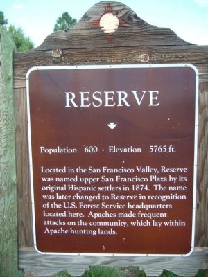
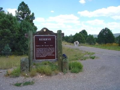
Located in the San Francisco Valley, Reserve was named upper San Francisco Plaza by its original Hispanic settlers in 1874. The name was later changed to Reserve in recognition of the U.S. Forest Service headquarters located here. Apaches made frequent attacks on the community, which lay within Apache hunting lands.
Topics. This historical marker is listed in these topic lists: Hispanic Americans • Native Americans • Settlements & Settlers.
Location. 33° 41.507′ N, 108° 51.688′ W. Marker is near Reserve, New Mexico, in Catron County. Marker is at the intersection of U.S. 180 at milepost 20.7 and State Road 12, on the right when traveling north on U.S. 180. Touch for map. Marker is in this post office area: Reserve NM 87830, United States of America. Touch for directions.
Other nearby markers. At least 2 other markers are within 7 miles of this marker, measured as the crow flies. A different marker also named Reserve (approx. 6 miles away); Elfego Baca (approx. 6.1 miles away).
Also see . . . Reserve, New Mexico. A Wikipedia article on Reserve. (Submitted on September 29, 2010.)
Photographed By Bill Kirchner, September 19, 2010
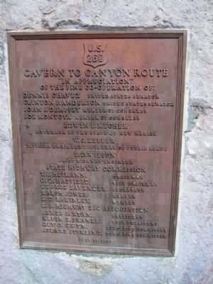
4. US 260 - Cavern to Canyon Route
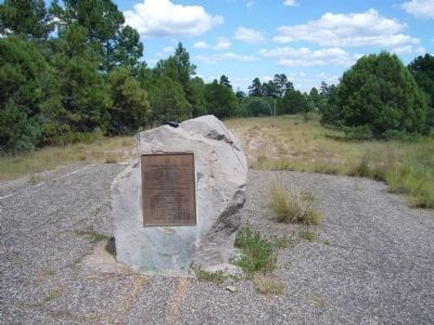
[This plaque is located near the marker:]
"In appreciation"
Of the fine co-operation of:
Dennis Chavez - United States Senator
Clinton P. Anderson - United States Senator
John J. Dempsey - Member of Congress
Joe Montoya - Member of Congress
Edwin L. Mechem
Governor of the State of New Mexico
W. J. Keller
Division Engineer U.S. Bureau of Public Roads
State Highway Commission
T.J. Heimann – Chairman • G.D. Hatfield - Vice Chairman • George Lavender – Secretary • Ralph Jones – Member • E.D. McKinley – Member
U.S. Highway 260 Association
James S. Ryan – President • Alvin E. Franks - Vice President • Guy O. Gwyn - Executive Committee • Stuart Stirling - Executive Committee
July 21, 1957
Of the fine co-operation of:
Dennis Chavez - United States Senator
Clinton P. Anderson - United States Senator
John J. Dempsey - Member of Congress
Joe Montoya - Member of Congress
Governor of the State of New Mexico
W. J. Keller
Division Engineer U.S. Bureau of Public Roads
State Highway Commission
Credits. This page was last revised on June 16, 2016. It was originally submitted on September 28, 2010, by Bill Kirchner of Tucson, Arizona. This page has been viewed 1,053 times since then and 35 times this year. Photos: 1, 2, 3, 4, 5. submitted on September 28, 2010, by Bill Kirchner of Tucson, Arizona. • Syd Whittle was the editor who published this page.
