Riverfront in Chattanooga in Hamilton County, Tennessee — The American South (East South Central)
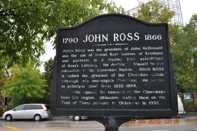
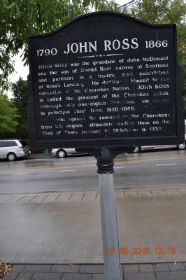
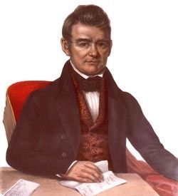
1790 John Ross 1866
He fought against the removal of the Cherokees from this region, ultimately leading them on the Trail of Tears journey to Oklahoma in 1838.
Topics and series. This historical marker is listed in this topic list: Native Americans. In addition, it is included in the Trail of Tears series list. A significant historical year for this entry is 1838.
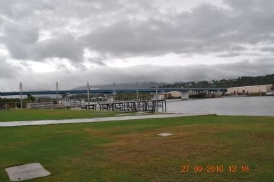
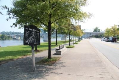
Location. 35° 3.387′ N, 85° 18.681′ W. Marker is in Chattanooga, Tennessee, in Hamilton County. It is in Riverfront. Marker can be reached from Riverfront Parkway. Located along the Chattanooga River walk near the Tennessee River, a few feet from Ross's Landing Marker. Just off Riverfront Parkway across the highway from the Tennessee Aquarium. Touch for map. Marker is in this post office area: Chattanooga TN 37401, United States of America. Touch for directions.
Other nearby markers. At least 8 other markers are within walking distance of this marker. Chattanooga's First Citizens (here, next to this marker); Ross's Landing (within shouting distance of this marker); "Cherokee" (about 300 feet away, measured in a direct line); a different marker also named Ross's Landing (about 300 feet away); Trail of Tears (about 400 feet away); Stickball / Seven Sisters (about 400 feet away); Hazen's Raid at Brown's Ferry (about 500 feet away); Ross's Landing: River Crossing and Port (approx. 0.2 miles away). Touch for a list and map of all markers in Chattanooga.
Also see . . . John Ross Wikipedia Entry. “In 1819, the Council sent Ross to Washington again. He was assuming a larger role among the leadership. The purpose of the delegation was to clarify the provisions of the Treaty of 1817. The delegation had to negotiate the limits of the ceded land and hope to clarify the Cherokee’s right to the remaining land. John C. Calhoun, the Secretary of War, pressed Ross to cede large tracts of land in Tennessee and Georgia. Such pressure from the US government would continue and intensify. In October 1822, Calhoun requested that the Cherokee relinquish their land claimed by Georgia, in fulfillment of the United States’ obligation under the Compact of 1802. Before responding to Calhoun’s proposition, Ross first ascertained the sentiment of the Cherokee people. They were unanimously opposed to cession of land.
“In January 1824, Ross traveled to Washington to defend the Cherokees’ possession of their land. Calhoun offered two solutions to the Cherokee delegation: either relinquish title to their lands and remove west, or accept denationalization and become citizens of the United States. Rather than accept Calhoun’s ultimatum, Ross made a bold departure from previous negotiations. He pressed the Nation’s complaints. On April 15, 1824, Ross took the dramatic step of directly petitioning Congress. This fundamentally altered the traditional relationship between an Indian nation and the US government.” (Submitted on October 17, 2010, by Tom Gillard of Tullahoma, Tennessee.)
Credits. This page was last revised on January 4, 2024. It was originally submitted on September 29, 2010, by Sandra Hughes Tidwell of Killen, Alabama, USA. This page has been viewed 1,144 times since then and 36 times this year. Last updated on January 1, 2024, by Amanda Zimmer of Atlanta, Georgia. Photos: 1, 2, 3, 4. submitted on September 29, 2010, by Sandra Hughes Tidwell of Killen, Alabama, USA. 5. submitted on June 10, 2015, by Dale K. Benington of Toledo, Ohio. 6. submitted on December 17, 2010, by J. J. Prats of Powell, Ohio. • James Hulse was the editor who published this page.
