Near Spotsylvania Courthouse in Spotsylvania County, Virginia — The American South (Mid-Atlantic)
Jackson's Impact
The Battle of Chancellorsville
— Fredericksburg and Spotsylvania National Military Park —
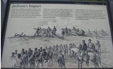
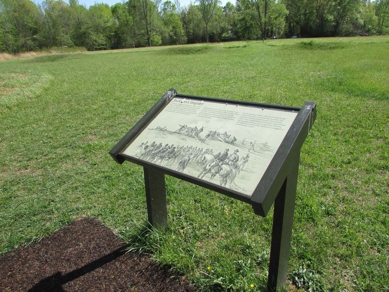
Around you is tangible and dramatic evidence of the impact "Stonewall" Jackson's flank attack had on the Union army. The artillery emplacements (lunettes) in front of you were constructed at a fairly leisurely rate on May 1 and 2, 1863. They face South, toward the expected direction of any Confederate attack.
The lunettes to your left were dug by frantic Union artillerymen during the night of May 2-3, 1863. They face west - in the direction of Jackson's surprise assault against the Union right flank. Few attacks of the war so quickly and thoroughly changed the axis and the course of a battle.
On the morning of May 3, 1863, Union cannon and troops at Fairview came under furious attack. Lee assaulted Fairview from the south, while Jackson's force (now commanded by J.E.B. Stuart) attacked from the west and southwest. For several hours, Fairview became the focal point of the battle as Lee struggled to destroy Hooker's army.
Erected by National Park Service, U.S. Department of the Interior.
Topics. This historical marker is listed in this topic list: War, US Civil. A significant historical month for this entry is May 1863.
Location. 38° 18.456′ N, 77° 38.641′ W. Marker is near Spotsylvania Courthouse, Virginia, in Spotsylvania County. Marker can be reached from Berry Paxton Road, on the right when traveling east. Located at Fairview, stop ten of the driving tour of Chancellorsville Battlefield. The marker is also at stop five of the Hazel Grove-Fairview walking trail. Touch for map. Marker is in this post office area: Spotsylvania VA 22553, United States of America. Touch for directions.
Other nearby markers. At least 8 other markers are within walking distance of this marker. High Drama, Human Tragedy (here, next to this marker); Artillery Duel (within shouting distance of this marker); Fairview (within shouting distance of this marker); Ordeal of the Wounded (within shouting distance of this marker); a different marker also named Fairview (within shouting distance of this marker); Chancellor Cemetery (about 300 feet away, measured in a direct line); Collis Zouaves (approx. 0.2 miles away); The 27th Indiana Infantry (approx. ¼ mile away). Touch for a list and map of all markers in Spotsylvania Courthouse.
More about this marker. The background of the marker is a drawing of an artillery battery in action while an infantry line stands in support.
Regarding Jackson's Impact. This is one of several markers for the Battle of Chancellorsville at Hazel Grove and Fairview, the central part of the battle. See the Hazel Grove - Fairview Virtual Tour by Markers in the links section for a listing of related markers on the tour.
Also see . . .
Photographed By Craig Swain, November 10, 2007
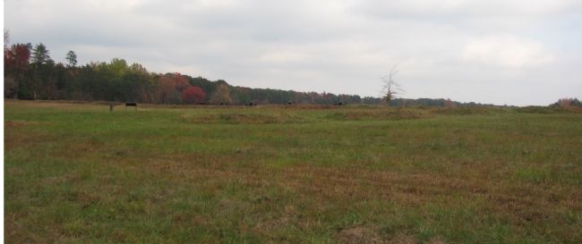
2. Fairview Lunettes
Note the line of empty lunettes in the foreground running across the photo. Then note the second set of artillery positions, marked by the cannon in the background. The markers for trail stop five are located just to the left in the photo.
Photographed By Craig Swain, November 10, 2007
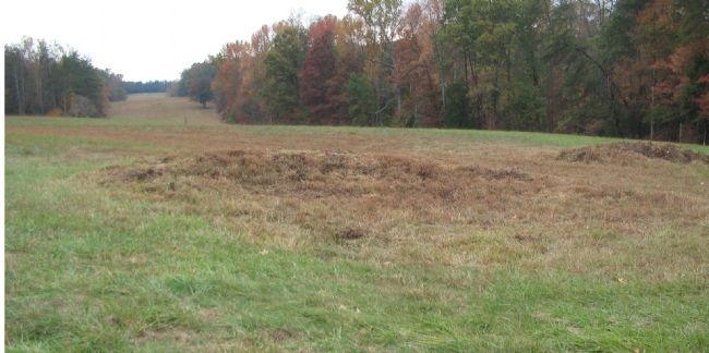
4. Original Artillery Line Flanked by Hazel Grove
Here one can easily see the predicament Union artillery-men were in. In the foreground are the line of lunettes they originally placed in order to defend this site. But in the distance to the west (left center) is Hazel Grove, where some thirty Confederate guns would be in place to fire on the Federals. Confederate infantry advanced up the wooded ravine on the right side of this photo, encountering several Federal units, to include the 114th Pennsylvania Infantry.
Photographed By Craig Swain, November 10, 2007
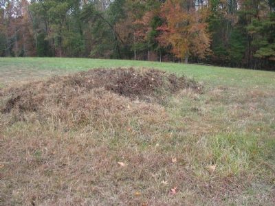
5. An Artillery Lunette
Compare this field fortification to the fixed artillery emplacements at Fort Collier (Winchester), Fort Mayfield (Manassas), or any of the Washington, D.C. forts such as Fort Totten or Fort Stevens. Field fortifications tend to be lower in profile, sinking the artillery piece lower to the ground. Where as fixed fortification emplacements tend to elevate the artillery piece in profile. Field fortifications need to offer protection from enemy fire in addition to concealment. In a perfect position, the field fortification offers the enemy only a view of the cannon's muzzle.
On the other hand with fixed fortifications, it can be assumed the enemy knows where the fort is generally located, so concealment isn't as high a priority. In order to offer a wider, clearer field of fire, the cannon is often placed on an elevated platform. Additional protection is provided in the fixed fortifications with ramparts, since time permits the additional earth moving.
On the other hand with fixed fortifications, it can be assumed the enemy knows where the fort is generally located, so concealment isn't as high a priority. In order to offer a wider, clearer field of fire, the cannon is often placed on an elevated platform. Additional protection is provided in the fixed fortifications with ramparts, since time permits the additional earth moving.
Credits. This page was last revised on April 25, 2023. It was originally submitted on November 18, 2007, by Craig Swain of Leesburg, Virginia. This page has been viewed 1,218 times since then and 10 times this year. Photos: 1, 2. submitted on November 18, 2007, by Craig Swain of Leesburg, Virginia. 3. submitted on April 24, 2023, by Bill Coughlin of Woodland Park, New Jersey. 4, 5. submitted on November 18, 2007, by Craig Swain of Leesburg, Virginia.
