Near Genoa in Vernon County, Wisconsin — The American Midwest (Great Lakes)
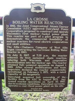
La Crosse Boiling Water Reactor
The Allis-Chalmers Company of West Allis began constructing the La Crosse Boiling Water Reactor in 1963.
On July 11, 1967, at 7:39 p.m., the reactor achieved its first sustained chain reaction, ushering both Wisconsin and cooperative electrification into the nuclear age. The reactor attained full-powered operation on August 1, 1969. After several modifications and tests, inspectors declared the reactor commercially operational on February 1, 1971, with a rated capacity of 50 megawatts.
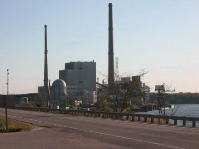
Dairyland acquired full ownership of the facility from the AEC in August 1973, but ceased reactor operations on April 30, 1987, due to economic conditions. Dairyland currently operates a coal-fired power plant on this site.
Erected 2008 by the Wisconsin Historical Society. (Marker Number 223.)
Topics and series. This historical marker is listed in these topic lists: Industry & Commerce • Notable Events. In addition, it is included in the Wisconsin Historical Society series list. A significant historical month for this entry is February 1945.
Location. 43° 34.031′ N, 91° 13.733′ W. Marker is near Genoa, Wisconsin, in Vernon County. Marker is on Great River Road (State Highway 35) 0.3 miles south of Main Street (State Highway 56), on the left when traveling south. Marker is at a highway pull-off. Touch for map. Marker is in this post office area: Genoa WI 54632, United States of America. Touch for directions.
Other nearby markers. At least 8 other markers are within 10 miles of this marker, measured as the crow flies. Dams on the Mississippi (here, next to this marker); Site of Red Bird's Village (approx. 3.8 miles away); Black Hawks Outpost (approx. 7.3 miles away); Battle of Bad Axe (approx. 7.7 miles away); Black Hawk War (approx. 7.7 miles away); Head of Battle Isle (approx. 7.7 miles away); Black Hawk and Winnebago Trail (approx. 9.6 miles away); Chief Win-no-shik, the Elder (approx. 9.7 miles away).
More about this marker. This historical marker memorializing Wisconsin's entry into the nuclear age was constructed about a half a mile north of the original marker. The previous marker was located on private property of the Dairyland Power Cooperative and, due to increased security requirements of having a closed nuclear plant, was no longer accessible to the public. At the request of the Mississippi River Parkyway Commission, Dairyland paid for and installed this new marker, with updated text. The plant closed in 1987, which was not reflected in the text of the previous marker. The new marker is available to the public 24 hours a day.
Credits. This page was last revised on October 24, 2020. It was originally submitted on October 15, 2009, by Keith L of Wisconsin Rapids, Wisconsin. This page has been viewed 1,389 times since then and 46 times this year. Last updated on October 2, 2010, by William J. Toman of Green Lake, Wisconsin. Photos: 1, 2, 3. submitted on October 15, 2009, by Keith L of Wisconsin Rapids, Wisconsin. • Bill Pfingsten was the editor who published this page.

![La Crosse Boiling Water Reactor Marker <i>[left side]</i>. Click for full size. La Crosse Boiling Water Reactor Marker <i>[left side]</i> image. Click for full size.](Photos/80/Photo80711.jpg?11252005)
