Near Spotsylvania Courthouse in Spotsylvania County, Virginia — The American South (Mid-Atlantic)
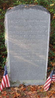
The 27th Indiana Infantry
Held this position from 7 p.m.
May 2nd to 9 a.m. May 3rd, 1863.
Present for duty 300
Killed 36, Wounded 114
Mustered in Aug. 1861, Mustered out Sept. 1864
Total enrollment 1,101. Killed 172.
Brown S. History 27th Indiana Infantry
Topics. This historical marker is listed in this topic list: War, US Civil. A significant historical month for this entry is May 1812.
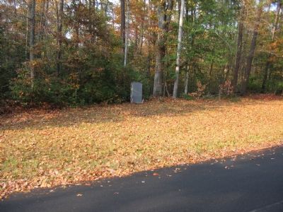
Location. 38° 18.29′ N, 77° 38.763′ W. Marker is near Spotsylvania Courthouse, Virginia, in Spotsylvania County. Marker is on Berry Paxton Road, on the right when traveling west. Located at Fairview, stop ten of the driving tour of Chancellorsville Battlefield. The marker is also at stop seven of the Hazel Grove-Fairview walking trail. Touch for map. Marker is in this post office area: Spotsylvania VA 22553, United States of America. Touch for directions.
Other nearby markers. At least 8 other markers are within walking distance of this marker. Fairview (approx. 0.2 miles away); Ordeal of the Wounded (approx. 0.2 miles away); a different marker also named Fairview (approx. 0.2 miles away); Artillery Duel (approx. 0.2 miles away); Jackson's Impact (approx. ¼ mile away); High Drama, Human Tragedy (approx. ¼ mile away); Chancellor Cemetery (approx. ¼ mile away); Chancellorsville Campaign (approx. 0.3 miles away). Touch for a list and map of all markers in Spotsylvania Courthouse.
Click on the ad for more information.
Please report objectionable advertising to the Editor.
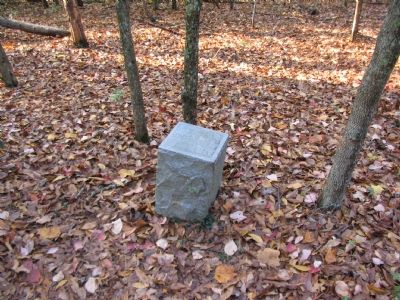
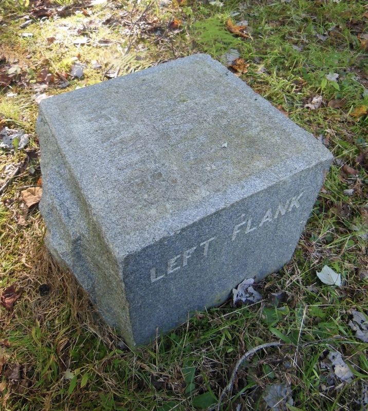
sectionhead>More about this marker. Two marker stones designate the left and right flank of the regiment.Please report objectionable advertising to the Editor.
Regarding The 27th Indiana Infantry. This is one of several markers for the Battle of Chancellorsville at Hazel Grove and Fairview, the central part of the battle. See the Hazel Grove - Fairview Virtual Tour by Markers in the links section for a listing of related markers on the tour.
Also see . . .
1. Battle of Chancellorsville. National Park Service site. (Submitted on November 18, 2007, by Craig Swain of Leesburg, Virginia.)
2. Hazel Grove - Fairview Walking Trail. A one mile walk through the scene of the heavy fighting on May 2-3, 1863. (Submitted on November 18, 2007, by Craig Swain of Leesburg, Virginia.)
3. 27th Indiana Volunteer Infantry Regiment. An extensive site detailing the men and the history of the regiment. Those who follow the markers might recall seeing the 27th Indiana mentioned as the unit that found the "Lost Order" at Monocacy Junction near Frederick, Maryland, leading up to the Battle of Antietam. (Submitted on November 18, 2007, by Craig Swain of Leesburg, Virginia.)
4. Hazel Grove - Fairview Virtual Tour by Markers. The Hazel Grove and Fairview portions of the battlefield (stops nine and ten on the driving tour of the battlefield). Markers along this tour include those on Stuart and Slocum Drives. (Submitted on November 18, 2007, by Craig Swain of Leesburg, Virginia.)
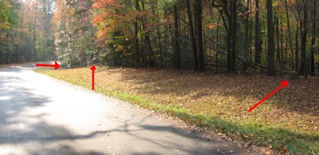
Photographed By Craig Swain, November 10, 2007
3. Position of the 27th Indiana
The left most red arrow indicates the location of the left flank marker stone. The center red arrow points to the Regimental marker. The right side arrow points to the right flank marker stone. Colonel Silas Colgrove led the 27th Indiana into the battle. As units around him collapsed, he rounded up stragglers and formed them around his unit, these augmenters included two cannon. During the fighting, he directed his son, who was the regiment's major, "Here boy, you run the regiment while I run this here gun!" The arrows here give an impression of the narrow confines in which units fought during the Civil War. Imagine similar regiments flanking both sides - thousands of men packed into such narrow spaces contributed to the high casualty rates.
Credits. This page was last revised on July 9, 2021. It was originally submitted on November 18, 2007. This page has been viewed 1,319 times since then and 13 times this year. Last updated on November 7, 2020, by Bradley Owen of Morgantown, West Virginia. Photos: 1, 2, 3, 4. submitted on November 18, 2007, by Craig Swain of Leesburg, Virginia. 5. submitted on May 29, 2021, by Bradley Owen of Morgantown, West Virginia. • J. Makali Bruton was the editor who published this page.
