Marker Logo HMdb.org THE HISTORICAL
MARKER DATABASE
“Bite-Size Bits of Local, National, and Global History”
Near Shiprock in San Juan County, New Mexico — The American Mountains (Southwest)
 

Beclabito Dome


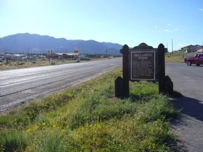
Beclabito Dome Marker image. Click for full size.
Photographed By Bill Kirchner, September 21, 2010
1. Beclabito Dome Marker
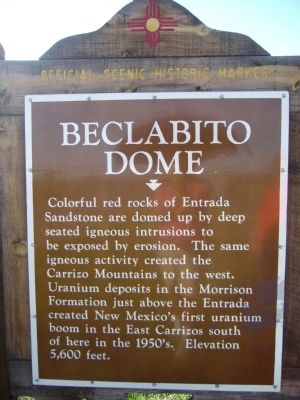
Inscription. Colorful red rocks of Entrada Sandstone are domed up by deep seated igneous intrusions to be exposed by erosion. The same igneous activity created the Carrizo Mountains to the west. Uranium deposits in the Morrison Formation just above the Entrada created New Mexico's first uranium boom in the East Carrizo south of here in the 1950's. Elevation 5,600 feet.
 
Topics. This historical marker is listed in these topic lists: Natural FeaturesNatural Resources.
 
Location. 36° 49.869′ N, 109° 0.899′ W. Marker is near Shiprock, New Mexico, in San Juan County. Marker is on State Route 504 (U.S. 64 at milepost 3.5), on the right when traveling west. Touch for map. Marker is in this post office area: Shiprock NM 87420, United States of America. Touch for directions.
 
Other nearby markers. At least 6 other markers are within 12 miles of this marker, measured as the crow flies. Welcome to Four Corners Monument! (approx. 11˝ miles away); Four Corners – A Common Bond (approx. 11.7 miles away); New Mexico (approx. 11.7 miles away); Arizona (approx. 11.7 miles away in Arizona); Colorado (approx. 11.7 miles away in Colorado); Utah (approx. 11.7 miles away in Utah).
 
Regarding Beclabito Dome. The Navajo name is "Bit"aa bito" (water beneath).
 
Paid Advertisement
Click on the ad for more information.
Please report objectionable advertising to the Editor.
Click or scan to see
this page online
Rear of Beclabito Dome Marker image. Click for full size.
Photographed By Bill Kirchner, September 21, 2010
2. Rear of Beclabito Dome Marker
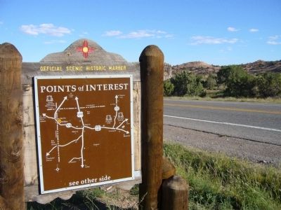
Beclabito Dome Marker image. Click for full size.
Photographed By Bill Kirchner, September 21, 2010
3. Beclabito Dome Marker
 
 
Credits. This page was last revised on June 16, 2016. It was originally submitted on October 3, 2010, by Bill Kirchner of Tucson, Arizona. This page has been viewed 1,273 times since then and 36 times this year. Photos:   1, 2, 3. submitted on October 3, 2010, by Bill Kirchner of Tucson, Arizona. • Syd Whittle was the editor who published this page.
Share this page.  
Share on Tumblr
m=36455

CeraNet Cloud Computing sponsors the Historical Marker Database.
This website earns income from purchases you make after using our links to Amazon.com. We appreciate your support.
Paid Advertisement
Apr. 16, 2024