Uptown District in Columbus in Franklin County, Ohio — The American Midwest (Great Lakes)
The Refugee Tract
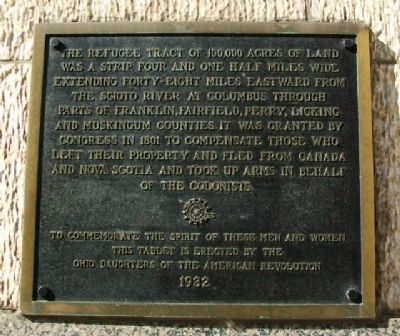
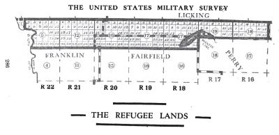
The Refugee Tract of 100,000 acres of land was a strip four and one half miles wide extending forty-eight miles eastward from the Scioto River at Columbus through parts of Franklin, Fairfield, Perry, Licking and Muskingum Counties. It was granted by Congress in 1801 to compensate those who left their property and fled from Canada and Nova Scotia and took up arms in behalf of the colonists.
To commemorate the spirit of these men and women, this tablet is erected by the Ohio Daughters of the American Revolution
Erected 1932 by Ohio Daughters of the American Revolution.
Topics and series. This historical marker is listed in these topic lists: Patriots & Patriotism • Settlements & Settlers • War, US Revolutionary. In addition, it is included in the Daughters of the American Revolution series list. A significant historical year for this entry is 1801.
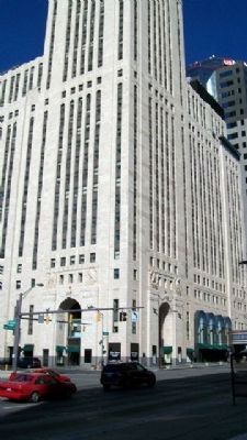
Location. 39° 57.732′ N, 83° 0.137′ W. Marker is in Columbus, Ohio, in Franklin County. It is in the Uptown District. Marker is at the intersection of Broad Street (U.S. 40) and Front Street, on the right when traveling west on Broad Street. Marker is on the wall of the Levesque Tower. Touch for map. Marker is at or near this postal address: 34 West Broad Street, Columbus OH 43215, United States of America. Touch for directions.
Other nearby markers. At least 8 other markers are within walking distance of this marker. M. D. Portman Plaza (about 300 feet away, measured in a direct line); Intersect (about 400 feet away); The State House (about 500 feet away); The Unknown Boy Scout (about 500 feet away); Charity Newsies (about 600 feet away); The Supreme Court of Ohio (about 700 feet away); Trinity Episcopal Church (about 700 feet away); William McKinley (about 700 feet away). Touch for a list and map of all markers in Columbus.
Also see . . .
1. The Refugee Tract. (Submitted on October 6, 2010, by William Fischer, Jr. of Scranton, Pennsylvania.)
2. The Official Ohio Lands Book. (Submitted on October 6, 2010, by William Fischer, Jr. of Scranton, Pennsylvania.)
3. The Refugee Tract. (Submitted on October 6, 2010, by William Fischer, Jr. of Scranton, Pennsylvania.)
Credits. This page was last revised on February 3, 2023. It was originally submitted on October 6, 2010, by William Fischer, Jr. of Scranton, Pennsylvania. This page has been viewed 1,097 times since then and 28 times this year. Photos: 1, 2, 3. submitted on October 6, 2010, by William Fischer, Jr. of Scranton, Pennsylvania.


