El Cerrito in Contra Costa County, California — The American West (Pacific Coastal)
Ranchos San Pablo and San Antonio Boundary Monument
Inscription.
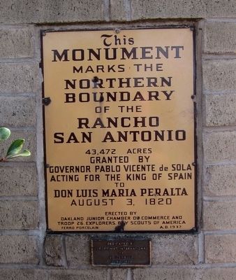
{North-facing side:}
Monument
marks the
Northern
Boundary
of the
Rancho
San Antonio
43,473 acres
granted by
Governor Pablo Vicente de Sola
acting for the King of Spain
to Don Luis Maria Peralta
August 3, 1820
Erected by
Oakland Junior Chamber of Commerce and
Troop 26, Explorers, Boy Scouts of America
Ferro Porcelain • A.D.1937
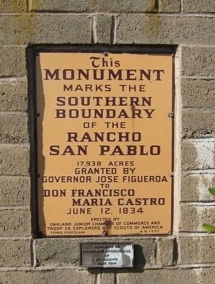
{South-facing side:}
Monument
marks the
southern boundary
of the
Rancho
San Pablo
17,938 acres
granted by
Governor Jose Figueroa
to
Don Francisco
Maria Castro
June 12, 1834
Erected by
Oakland Junior Chamber of Commerce and
Troop 26, Explorers, Boy Scouts of America
Ferro Porcelain • A.D.1937
Erected 1937 by Oakland Junior Chamber of Commerce and Boy Scouts of America Explorer Troop 26.
Topics. This historical marker and monument is listed in this topic list: Settlements & Settlers. A significant historical month for this entry is June 1929.
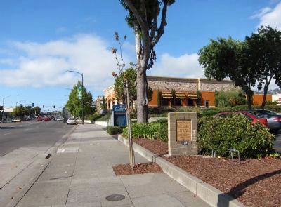
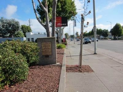
Location. 37° 53.88′ N, 122° 18.075′ W. Marker is in El Cerrito, California, in Contra Costa County . Marker is at the intersection of San Pablo Avenue and Kains Avenue, on the right when traveling north on San Pablo Avenue. The marker can be found on the east side of San Pablo Avenue, approximately at the Albany-El Cerrito Border, on a stone monument in front of the Wells Fargo Bank. Touch for map. Marker is at or near this postal address: 9800 San Pablo Avenue, El Cerrito CA 94530, United States of America. Touch for directions.
Other nearby markers. At least 8 other markers are within walking distance of this marker. Site of Miller's Barn (about 300 feet away, measured in a direct line); Cerrito Creek (about 400 feet away); Historic Cerrito Creek (about 400 feet away); The Adobe Houses of Victor Castro (about 400 feet away); El Cerrito Hills (about 500 feet away); El Cerrito's Nightlife (approx. 0.2 miles away); The Little Hill (approx. 0.2 miles away); Rust (approx. 0.2 miles away). Touch for a list and map of all markers in El Cerrito.
More about this monument. Both sides of the marker's monument have small plaques mounted directly below the main ones to indicate that it was dedicated by the Soroptimist International in June, 1977.
Related marker. Click here for another marker that is related to this marker. The Rancho San Antonio State Historic Landmark Marker.
Also see . . . Rancho San Pablo. A transcript of A.F. Bray's December 1936 radio piece on the history of Rancho San Pablo.
(Submitted on October 15, 2010.)
Credits. This page was last revised on November 30, 2022. It was originally submitted on October 9, 2010, by Andrew Ruppenstein of Lamorinda, California. This page has been viewed 997 times since then and 19 times this year. Photos: 1, 2. submitted on October 9, 2010, by Andrew Ruppenstein of Lamorinda, California. 3, 4. submitted on October 15, 2010, by Andrew Ruppenstein of Lamorinda, California. • Syd Whittle was the editor who published this page.


