Marker Logo HMdb.org THE HISTORICAL
MARKER DATABASE
“Bite-Size Bits of Local, National, and Global History”
Rehoboth Beach in Sussex County, Delaware — The American Northeast (Mid-Atlantic)
 

City of Rehoboth Beach


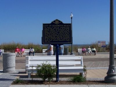
City of Rehoboth Beach Marker image. Click for full size.
Photographed By Mike Stroud, October 16, 2011
1. City of Rehoboth Beach Marker
Inscription. On January 27, 1873, the “Rehoboth Beach Camp Meeting Association of the Methodist Episcopal Church” was incorporated by the Delaware legislature for the purpose of establishing “a permanent camp meeting ground and Christian sea-side resort.” With the coming of the railroad in 1878, the growth of the community was accelerated. On March 19, 1891, an act was passed incorporating the municipality as Cape Henlopen City. The name was formally changed to Rehoboth in 1893. Since its founding the City of Rehoboth Beach has continued to be one of the most popular resorts on the Atlantic coast, attracting thousands of visitors each year.
 
Erected by The Delaware Public Archives. (Marker Number S-90.)
 
Topics and series. This historical marker is listed in these topic lists: Churches & ReligionParks & Recreational AreasRailroads & StreetcarsSettlements & Settlers. In addition, it is included in the Delaware Public Archives series list. A significant historical date for this entry is January 27, 1873.
 
Location. 38° 42.998′ N, 75° 4.569′ W. Marker is in Rehoboth Beach, Delaware, in Sussex County. Marker is on Rehoboth Avenue, (local road 15) (Delaware Route 1A) near Boardwalk at Atlantic Ocean, in the median. Touch for map. Marker is in this post office area: Rehoboth Beach DE 19971, United States of America. Touch for directions.
 
Other nearby markers.
Paid Advertisement
Click on the ad for more information.
Please report objectionable advertising to the Editor.
Click or scan to see
this page online
At least 8 other markers are within walking distance of this marker. Surf Safety Line (a few steps from this marker); Veterans Memorial (within shouting distance of this marker); The Bandstand (within shouting distance of this marker); Tommy Coveleski (about 400 feet away, measured in a direct line); Funland (about 700 feet away); Giovanni Da Verrazzano (approx. 0.2 miles away); World War I Memorial (approx. ¼ mile away); Village Improvement Association (approx. 0.3 miles away). Touch for a list and map of all markers in Rehoboth Beach.
 
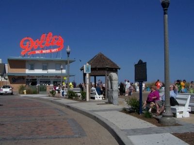
City of Rehoboth Beach Marker image. Click for full size.
Photographed By Mike Stroud, October 10, 2010
2. City of Rehoboth Beach Marker
City of Rehoboth Beach Marker, at the boardwalk at Rehoboth Ave. image. Click for full size.
Photographed By Mike Stroud, October 10, 2010
3. City of Rehoboth Beach Marker, at the boardwalk at Rehoboth Ave.
City of Rehoboth Beach Marker image. Click for full size.
Photographed By Mike Stroud, October 10, 2010
4. City of Rehoboth Beach Marker
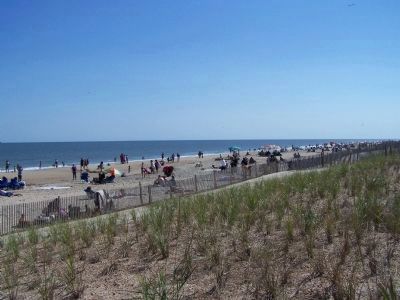
City of Rehoboth Beach October beach day image. Click for full size.
Photographed By Mike Stroud, October 10, 2010
5. City of Rehoboth Beach October beach day
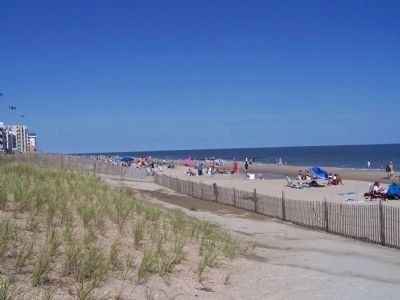
City of Rehoboth Beach Marker, looking north along the Atlantic Coast image. Click for full size.
Photographed By Mike Stroud, October 10, 2010
6. City of Rehoboth Beach Marker, looking north along the Atlantic Coast
City of Rehoboth Beach Boardwalk view image. Click for full size.
Photographed By Mike Stroud, October 10, 2010
7. City of Rehoboth Beach Boardwalk view
City of Rehoboth Beach image. Click for full size.
Photographed By Mike Stroud, October 10, 2010
8. City of Rehoboth Beach
City of Rehoboth Beach Ocean Facts image. Click for full size.
Photographed By Mike Stroud, October 13, 2010
9. City of Rehoboth Beach Ocean Facts
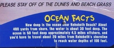
How deep is the ocean near Rehoboth Beach ? About 400 yards from shore, the water is about 30 feet deep. The ocean is 50 feet deep approximately 4.5 miles offshore, and you'd have to travel about 29 miles from Rehoboth's shoreline to reach water depths of 100 feet.
City of Rehoboth Beach Ocean Facts image. Click for full size.
Photographed By Mike Stroud, October 13, 2010
10. City of Rehoboth Beach Ocean Facts
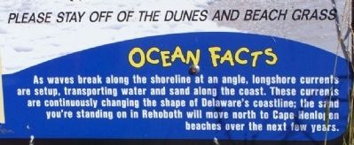
As waves break along the shoreline at an angle, longshore currents are setup, transporting water and sand along the coast. These currents are continuosly changing the shape of Delaware's coastline; the sand you're standing on in Rehoboth will move north to Cape Henlopen beaches over the next few years.
 
 
Credits. This page was last revised on September 19, 2023. It was originally submitted on October 10, 2010, by Mike Stroud of Bluffton, South Carolina. This page has been viewed 941 times since then and 41 times this year. Photos:   1, 2, 3, 4, 5, 6, 7, 8. submitted on October 10, 2010, by Mike Stroud of Bluffton, South Carolina.   9, 10. submitted on October 17, 2010, by Mike Stroud of Bluffton, South Carolina.

Share this page.  
Share on Tumblr
m=36783

CeraNet Cloud Computing sponsors the Historical Marker Database.
This website earns income from purchases you make after using our links to Amazon.com. We appreciate your support.
Paid Advertisement
Apr. 24, 2024