Stillwater in Saratoga County, New York — The American Northeast (Mid-Atlantic)
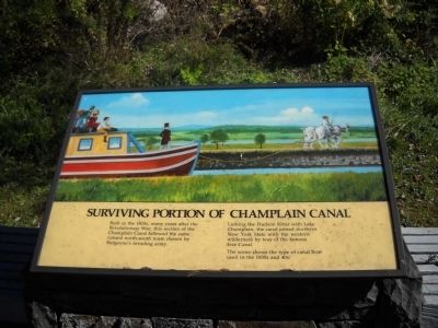
Surviving Portion of Champlain Canal
Linking the Hudson River with Lake Champlain, the canal joined northern New York State with the western wilderness by way of the Famous Erie Canal.
The scene shows the type of canal boat used in the 1830s and 40s.
Erected by National Park Service.
Topics and series. This historical marker is listed in this topic list: Waterways & Vessels. In addition, it is included in the Erie Canal series list.
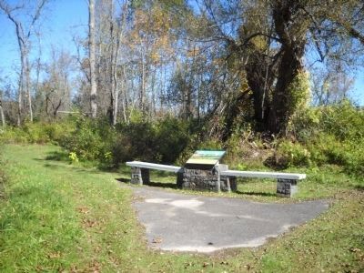
Location. 43° 0.277′ N, 73° 36.354′ W. Marker is in Stillwater, New York, in Saratoga County. Marker can be reached from Park Tour Road, on the right when traveling west. Marker is in Saratoga National Historic Park, on a walking trail that begins at the Fraser Burial Site stop on the auto tour road. Touch for map. Marker is in this post office area: Stillwater NY 12170, United States of America. Touch for directions.
Other nearby markers. At least 8 other markers are within walking distance of this marker. Site of the Taylor Cabin (within shouting distance of this marker); A Route Well Traveled (within shouting distance of this marker); Crown Forces Baggage Park (about 600 feet away, measured in a direct line); The Great Redoubt (approx. 0.2 miles away); Burial Site of General Fraser (approx. 0.2 miles away); Crown Forces Artillery Park (approx. 0.2 miles away); Retreat, Pursuit, and Surrender (approx. ¼ mile away); Main Crown Forces Hospital (approx. ¼ mile away). Touch for a list and map of all markers in Stillwater.
More about this marker. The top of the marker features a picture of a canal boat being pulled by a pair of horses.
Credits. This page was last revised on June 16, 2016. It was originally submitted on October 11, 2010, by Bill Coughlin of Woodland Park, New Jersey. This page has been viewed 701 times since then and 16 times this year. Photos: 1, 2, 3, 4. submitted on October 11, 2010, by Bill Coughlin of Woodland Park, New Jersey.


