Marker Logo HMdb.org THE HISTORICAL
MARKER DATABASE
“Bite-Size Bits of Local, National, and Global History”
Alabaster in Shelby County, Alabama — The American South (East South Central)
 

Nabors Cemetery

“Ozley-McLane-Nabors Cemetery”


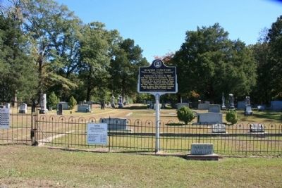
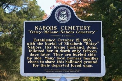
Nabors Cemetery Marker image. Click for full size.
Photographed By Tim & Renda Carr, October 17, 2010
1. Nabors Cemetery Marker
Inscription. Established October 15, 1868, with the burial of Elizabeth “Betsy” Nabors. Her loving husband, John, followed her in death only fifteen days later. They are buried side by side. Many local pioneer families chose to share this hallowed ground for their departed loved ones.
Listed in the Alabama Historic Cemetery Register

 
Erected by Alabama Historical Commission / Nabors Cemetery Association.
 
Topics. This historical marker is listed in this topic list: Cemeteries & Burial Sites. A significant historical date for this entry is October 15, 1891.
 
Location. 33° 12.392′ N, 86° 46.735′ W. Marker is in Alabaster, Alabama, in Shelby County. Marker is on Mellow Drive north of U.S. 31, on the right when traveling north. Touch for map. Marker is at or near this postal address: 949 Highway 31 S, Alabaster AL 35007, United States of America. Touch for directions.
 
Other nearby markers. At least 8 other markers are within 6 miles of this marker, measured as the crow flies. Benton Family Cemetery (approx. 2.8 miles away); Harless Cemetery (approx. 3.1 miles away); The Founding of Alabaster / Siluria (approx. 3.3 miles away); Pelham, Alabama / Ballantrae Golf Course (approx. 3.9 miles away); Cedar Grove Cemetery (approx. 4.9 miles away); David Lindsay (approx.
Paid Advertisement
Click on the ad for more information.
Please report objectionable advertising to the Editor.
Click or scan to see
this page online
4.9 miles away); Washington Hall / Birth of A Nation (approx. 5.4 miles away); The President's Oval Office / The Glorious Burden (approx. 5.4 miles away). Touch for a list and map of all markers in Alabaster.
 
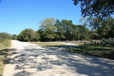
Mellow Drive and the Nabors Cemetery image. Click for full size.
Photographed By Tim & Renda Carr, October 17, 2010
2. Mellow Drive and the Nabors Cemetery
Nabors Cemetery Marker image. Click for full size.
Photographed By Tim & Renda Carr, October 17, 2010
3. Nabors Cemetery Marker
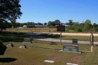
Nabors Cemetery Marker U.S. Highway 31 in the Distance. image. Click for full size.
Photographed By Tim & Renda Carr, October 17, 2010
4. Nabors Cemetery Marker U.S. Highway 31 in the Distance.
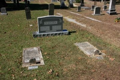
The Nabors Burial Site image. Click for full size.
Photographed By Tim & Renda Carr, October 17, 2010
5. The Nabors Burial Site
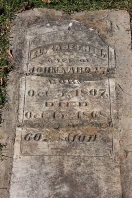
Grave of Elizabeth H. Nabors image. Click for full size.
Photographed By Tim & Renda Carr, October 17, 2010
6. Grave of Elizabeth H. Nabors
Wife of John Nabors
Born Oct. 5, 1807
Died Oct. 15, 1868
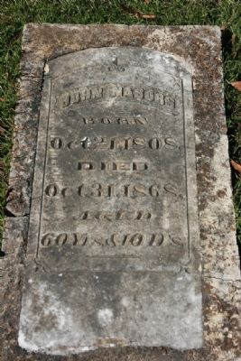
Grave of John Nabors image. Click for full size.
Photographed By Tim & Renda Carr, October 17, 2010
7. Grave of John Nabors
Born Oct. 21, 1808
Died Oct. 31, 1868
 
 
Credits. This page was last revised on June 16, 2016. It was originally submitted on October 18, 2010, by Timothy Carr of Birmingham, Alabama. This page has been viewed 1,346 times since then and 46 times this year. Photos:   1, 2, 3, 4, 5, 6, 7. submitted on October 18, 2010, by Timothy Carr of Birmingham, Alabama. • Syd Whittle was the editor who published this page.
Share this page.  
Share on Tumblr
m=37046

CeraNet Cloud Computing sponsors the Historical Marker Database.
This website earns income from purchases you make after using our links to Amazon.com. We appreciate your support.
Paid Advertisement
Apr. 16, 2024