Near Johnson Siding in Pennington County, South Dakota — The American Midwest (Upper Plains)
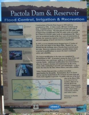
Pactola Dam & Reservoir
Flood Control, Irrigation & Recreation
In 1972, a severe thunderstorm dropped up to 17 inches of rain on the east slopes of the Black Hills. Rapid City was flooded but the drainage above Pactola Dam received much less rain. However, concerns about a possible future storm event led to modifications to ensure the dam's continued safety and reliability.
The largest modification to the dam was completed by Reclamation in 1987. It included raising the dam 15 feet and constructing a new and larger spillway to accommodate extreme floods. Additional modifications have been made to allow for frequent cleanup and maintenance in the outlet works while continuing to provide year-round instream flows below the dam for the blue ribbon fishery and other wildlife.
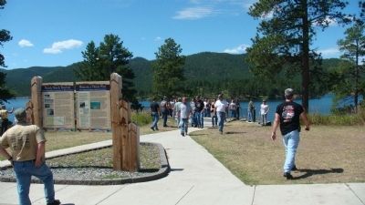
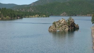
Today, Pactola Dam provides excellent recreation opportunities for the public. Reclamation, the U.S. Forest Service and the South Dakota Department of Game Fish and Parks work together to provide the public with one of the best sites in the Black Hills. U.S. Forest Service facilities adjacent to Pactola Reservoir include 2 campgrounds, 2 picnic areas, 4 hiking trails, 2 boat ramps, a swim beach, marina and visitor center.
Welcome to Pactola Reservoir!
Caption for top photo: The town of Pactola as seen before the reservoir was filled.
Caption for second-from-the-top photo: Early construction of Pactola Dam in 1954 as seen from the location of the present day Visitor Center.
Caption for third-from-the-top photo: A view of Rapid City during the flood of June 10, 1972. The deluge killed 236 people and destroyed $300 million worth of property.
Caption for bottom photo: A pipe is installed to provide releases for year-round needs of fish and wildlife downstream from the dam.
Erected by the U.S. Forest Service and the Bureau of Reclamation of the U.S. Department of the Interior.
Topics. This historical marker is listed in these topic lists: Man-Made Features • Waterways & Vessels. A significant historical date for this entry is June 10, 1952.
Location. 44° 4.539′ N, 103° 29.385′ W. Marker is near Johnson Siding, South Dakota, in Pennington County. Marker is on U.S. 385, 0.1 miles south of Pactola Basin Road, on the right when traveling south. Touch for map. Marker is in this post office area: Rapid City SD 57702, United States of America. Touch for directions.
Other nearby markers. At least 8 other markers are within 10 miles of this marker, measured as the crow flies. Water for a Thirsty West (here, next to this marker); Civilian Conservation Corps Camp (approx. half a mile away); a different marker also named Civilian Conservation Corps Camp (approx. 5.1 miles away); a different marker also named Civilian Conservation Corps Camp (approx. 6.8 miles away); Historic Madison Ranch (approx. 6.9 miles away); Sheridan (approx. 7˝ miles away); Castleton (approx. 8.3 miles away); a different marker also named Civilian Conservation Corps Camp (approx. 9.2 miles away). Touch for a list and map of all markers in Johnson Siding.
Credits. This page was last revised on June 16, 2016. It was originally submitted on October 18, 2010, by William J. Toman of Green Lake, Wisconsin. This page has been viewed 1,545 times since then and 34 times this year. Photos: 1, 2, 3. submitted on October 19, 2010, by William J. Toman of Green Lake, Wisconsin. • Syd Whittle was the editor who published this page.
Editor’s want-list for this marker. Photo of the dam. • Can you help?


