Folsom in Sacramento County, California — The American West (Pacific Coastal)
The Sacramento, Placer and Nevada Railroad Right of Way
Inscription.
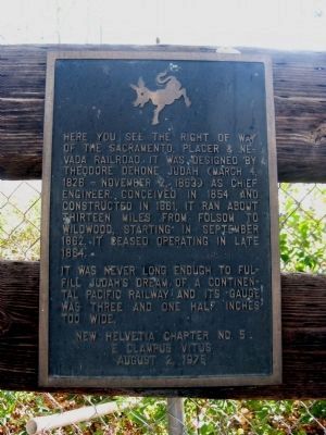
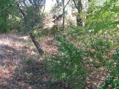
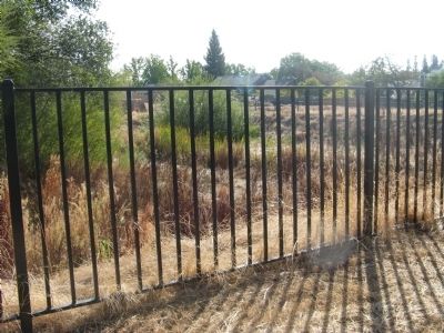
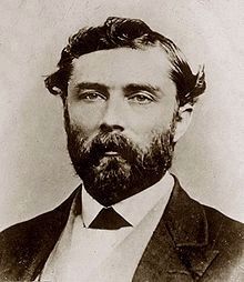
Here you can see the right of way of the Sacramento, Placer and Nevada Railroad. It was designed by Theodore Dehone Judah (March 4, 1826 – November 2, 1863) as Chief Engineer. Conceived in 1854 and constructed in 1861, it ran about thirteen miles from Folsom to Wildwood, starting in September 1862. It ceased operating in late 1864.
It was never long enough to fulfill Judah’s dream of a Continental Pacific Railway and its gauge was three and one half inches too wide.
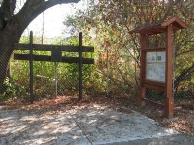
[ Information Posted on the Kiosk ]:
The story ends where you are standing.
Folsom was the site of the first attempt at the transcontinental railroad. Theodore Judah, a railroad engineer from Connecticut, brought his vision and intense passion to Sacramento to build the nation’s first transcontinental railroad.
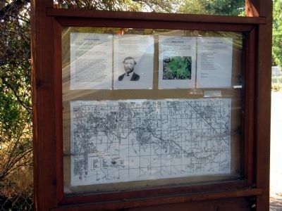
He was hired as the Chief Engineer for the Sacramento Valley Railroad, the first railroad west of the Mississippi, which ran from Sacramento to Folsom (it closely follows the current light-rail route.) He surveyed the route across the difficult Sierra Nevada for the nation’s transcontinental railroad. Struggling to find the funds to build this, he was successful in signing up four Sacramento merchants, the “Big Four,” who actually built the Central Pacific. After he lobbied Congress to pass the 1862 Pacific Railroad Act, which authorized construction of the First Transcontinental Railroad, the Big Four marginalized his involvement. Attempting to carry out his own vision, he started the Sacramento, Placer and Nevada Railroad from Ashland Station in Folsom, north to Wildwood, 13 miles closer to his route across the Sierras. (The map shows the right-of way on our current streets. Did the train go through your yard?) While it was used for two years, it was too short for much commercial value. Additionally, the track was 3 1/2 inches too wide for what later became the standard rail-to-rail width.
It is unclear if the track was abandoned because the route was not desirable or if the cost of placing the rails closer was prohibitive.
Dejected, Theodore Judah left California to return to the East Coast to find funding for his dream. He traveled by ship with a land crossing in Panama where he contracted Yellow Fever and died, his dream to be fulfilled by others.
To the left of you are vintage tracks on the right of way of the Sacramento, Placer and Nevada Railroad, the product of Theodore Judah’s dream.
For more information, please visit the
Folsom Railroad Museum at 198 Wool Street.
Erected 1975 by New Helvetia Chapter No.5, E Clampus Vitus.
Topics and series. This historical marker is listed in this topic list: Railroads & Streetcars. In addition, it is included in the E Clampus Vitus series list. A significant historical month for this entry is September 1862.
Location. 38° 42.362′ N, 121° 10.331′ W. Marker is in Folsom, California, in Sacramento County. Marker is on Lakeside Way south of Folsom Dam Road, on the left when traveling south. Marker is located just south of the entrance to the Lakeside Mobil Home Park. Touch for map. Marker is at or near this postal address: 210 Lakeside Way, Folsom CA 95630, United States of America. Touch for directions.
Other nearby markers. At least 8 other markers are within 2 miles of this marker, measured as the crow flies. Railroad Gate (approx. 1.1 miles away); Fire Extinguisher (approx. 1.1 miles away); Tree Stump Hitching Post (approx. 1.1 miles away); Sergeant C.W. Parker (approx. 1.1 miles away); Horse Head Hitching Post (approx. 1.1 miles away); Prison Doodlebug (approx. 1.1 miles away); Pioneer Express Trail (approx. 1.3 miles away); Folsom Institute (approx. 1.6 miles away).
Also see . . .
1. Theodore Judah. The first railroad to be built on the Pacific Coast was completed in February 1856 and the town of Folsom
was established at its eastern terminus. (Submitted on October 21, 2010.)
2. The Sacramento, Placer and Nevada Railroad. The five foot guage Sacramento, Placer & Nevada RR was proposed to run from Folsom through Auburn on to Nevada City and hence over the Sierras. (Submitted on October 21, 2010.)
3. Theodore Judah. Information from the American Experience episode shown on PBS Television. (Submitted on October 25, 2010.)
Credits. This page was last revised on June 16, 2016. It was originally submitted on October 21, 2010, by Syd Whittle of Mesa, Arizona. This page has been viewed 1,606 times since then and 30 times this year. Photos: 1, 2, 3, 4, 5, 6. submitted on October 21, 2010, by Syd Whittle of Mesa, Arizona. 7. submitted on October 25, 2010, by Syd Whittle of Mesa, Arizona.
