Near Bentonville in Page County, Virginia — The American South (Mid-Atlantic)
Battle of Milford
Guarding Early's Flank
Inscription.
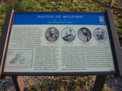
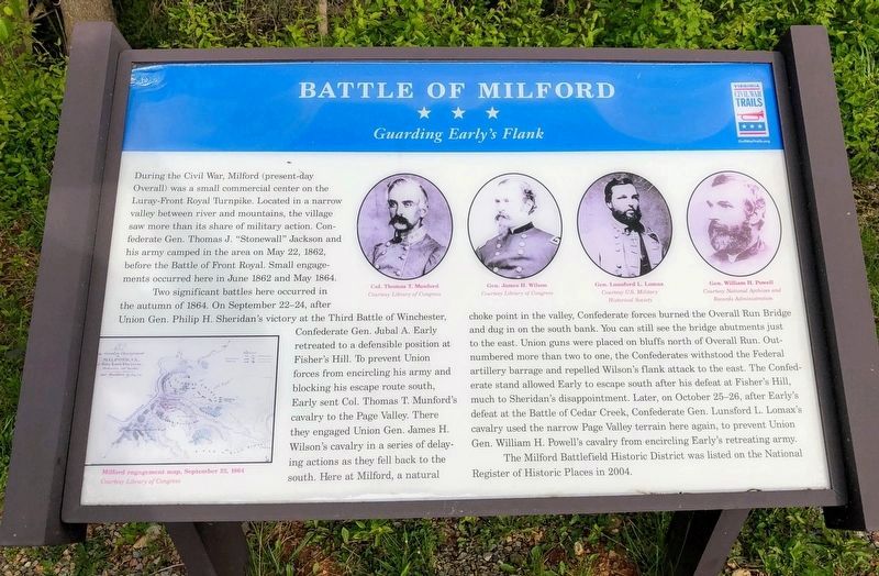
During the Civil War, Milford (present-day Overall) was a small commercial center on the Luray-Front Royal Turnpike. Located in a narrow valley between river and mountains, the village saw more than its share of military action. Confederate Gen. Thomas J. "Stonewall" Jackson and his army camped in the area on May 22, 1862, before the Battle of Front Royal. Small engagements occurred here in June 1862 and May 1864.
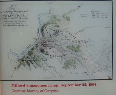
Two significant battles here occurred in the autumn of 1864. On September 22-24, after Union Gen. Philip H. Sheridan's victory at the Third Battle of Winchester, Confederate Gen. Jubal A. Early retreated to a defensible position at Fisher's Hill. To prevent Union forces from encircling his army and blocking his escape route south, Early sent Col. Thomas T. Munford's cavalry to the Page Valley. There they engaged Union Gen. James H. Wilson's cavalry in a series of delaying actions as they fell back to the south. Here at Milford, a natural choke point in the valley, Confederate forces burned the Overall Run Bridge and dug in on the south bank. You can still see the bridge abutments just to the east. Union guns were placed on the bluffs north of Overall Run. Outnumbered more than two to one, the Confederates withstood the Federal artillery barrage and repelled Wilson's flank attack to the east. The Confederate stand allowed Early to escape south after his defeat at Fisher's Hill, much to Sheridan's disappointment. Later, on October 25-26, after Early's defeat at the Battle of Cedar Creek, Confederate Gen. Lunsford L. Lomax's cavalry used the narrow Page Valley terrain here again, to prevent Union Gen. William H. Powell's cavalry from encircling Early's retreating army.
The Milford Battlefield Historic District was listed on the National Register of Historic Places in 2004.
Erected by Virginia Civil War Trails.
Topics and series. This historical marker is listed in this topic list: War, US Civil. In addition, it is included in the Virginia Civil War Trails series list. A significant historical month for this entry is May 1864.
Location. 38° 48.337′ N, 78° 20.95′ W. Marker is near Bentonville, Virginia, in Page County. Marker is at the intersection of Stonewall Jackson Highway (U.S. 340) and Overall Road, on the right when traveling north on Stonewall Jackson Highway. Touch for map. Marker is at or near this postal address: 11785 U S Hwy 340n, Bentonville VA 22610, United States of America. Touch for directions.
Other nearby markers. At least 8 other markers are within 5 miles of this marker, measured as the crow flies. U.S. Route 340 (here, next to this marker); The Historic Page Valley (here, next to this marker); Overall Bridge (here, next to this marker); Warren County / Page County (about 400 feet away, measured in a direct line); Everett Cullers Overlook (approx. 4 miles away); Fort Valley Church of God in Christ Jesus (approx. 4.7 miles away); Help Wanted! (approx. 4.8 miles away); Civilian Conservation Corps (approx. 4.8 miles away). Touch for a list and map of all markers in Bentonville.
Credits. This page was last revised on July 8, 2021. It was originally submitted on October 25, 2010, by Craig Swain of Leesburg, Virginia. This page has been viewed 2,071 times since then and 53 times this year. Photos: 1. submitted on October 25, 2010, by Craig Swain of Leesburg, Virginia. 2. submitted on May 18, 2021, by Shane Oliver of Richmond, Virginia. 3, 4. submitted on October 25, 2010, by Craig Swain of Leesburg, Virginia.


