Columbus in Hickman County, Kentucky — The American South (East South Central)
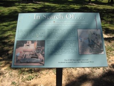
In Search Of ....
In 1984, a local historian and park volunteer, Mr. Eddie Roberts, began efforts to determine the location of the cannon by using maps and area surveys. In 1991, under Mr. Roberts' direction, the U.S. Army Corps of Engineers dug several sites at the base of the bluff, but failed to find the cannon.
Roberts discovered the exact location of the cannon in 1998 by using a magnetometer. This instrument is used for comparing the intensity and direction of magnetic fields. Cannon #209 was buried at a depth of 42 feet. This was 20 feet deeper and about 8 feet south of where the 1991 search had ended.
Approval was obtained from Kentucky State Parks and Kentucky State Archaeological Office to recover the cannon. With the generous assistance and donations of local excavation and towing businesses; the cannon was successfully dug up and transported to the park. Without the volunteer efforts of the community the project would not have been possible. Their help and encouragement is greatly appreciated.
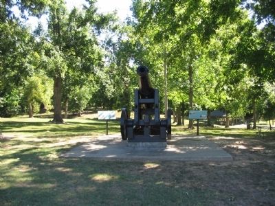
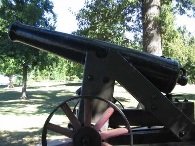
Now # 209 has again returned to stand its watch over the Mississippi River.
Topics. This historical marker is listed in this topic list: War, US Civil. A significant historical year for this entry is 1984.
Location. 36° 46.006′ N, 89° 6.677′ W. Marker is in Columbus, Kentucky, in Hickman County. Located in Columbus-Belmont State Park. Touch for map. Marker is in this post office area: Columbus KY 42032, United States of America. Touch for directions.
Other nearby markers. At least 8 other markers are within walking distance of this marker. Polk's Firepower (a few steps from this marker); Anchor and Chain (within shouting distance of this marker); Confederate Trenches (within shouting distance of this marker); The Mississippi River in the Civil War (within shouting distance of this marker); "Gibraltar of the West" (about 400 feet away, measured in a direct line); The History of Columbus, Kentucky (about 400 feet away); The Battle at Belmont, Missouri (about 500 feet away); Fourth United States Colored Heavy Artillery (about 700 feet away). Touch for a list and map of all markers in Columbus.
Credits. This page was last revised on June 16, 2016. It was originally submitted on October 27, 2010, by Craig Swain of Leesburg, Virginia. This page has been viewed 904 times since then and 14 times this year. Photos: 1, 2, 3. submitted on October 27, 2010, by Craig Swain of Leesburg, Virginia.


