Murfreesboro in Rutherford County, Tennessee — The American South (East South Central)
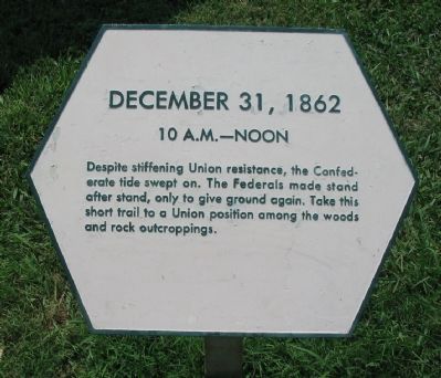
December 31, 1862
10 A.M. - Noon
Topics. This historical marker is listed in this topic list: War, US Civil.
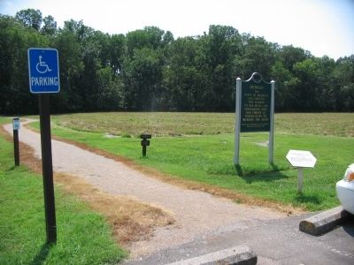
Location. Marker has been reported permanently removed. It was located near 35° 52.147′ N, 86° 25.968′ W. Marker was in Murfreesboro, Tennessee, in Rutherford County. Marker was on Park Road, on the left when traveling south. Located at stop two, the Slaughter Pen, on the driving tour of Stones River National Battlefield. Touch for map. Marker was in this post office area: Murfreesboro TN 37129, United States of America.
We have been informed that this sign or monument is no longer there and will not be replaced. This page is an archival view of what was.
Other nearby markers. At least 8 other markers are within walking distance of this location. Michigan (here, next to this marker); Sheridan's Stand (about 300 feet away, measured in a direct line); Boys, you must get out of here! You are surrounded! (about 300 feet away); Sheridan Saves the Day (about 600 feet away); Why Fight Here? (approx. ¼ mile away); Battle at Stones River (approx. ¼ mile away); This Far, But No Farther (approx. half a mile away); The Fight for the Cedars (approx. half a mile away). Touch for a list and map of all markers in Murfreesboro.
Also see . . . Stones River National Battlefield. National Park Service website. (Submitted on October 31, 2010, by Craig Swain of Leesburg, Virginia.)
Credits. This page was last revised on March 14, 2021. It was originally submitted on October 31, 2010, by Craig Swain of Leesburg, Virginia. This page has been viewed 769 times since then and 10 times this year. Last updated on March 13, 2021, by Shane Oliver of Richmond, Virginia. Photos: 1, 2, 3. submitted on October 31, 2010, by Craig Swain of Leesburg, Virginia. • Bill Pfingsten was the editor who published this page.


