Puerto Palomas de Villa in Ascensión, Chihuahua, Mexico — The Northwest (North America)
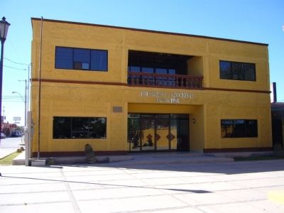
Presidency Building
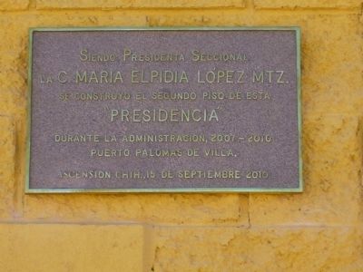
La C. Maria Elpidia Lopex Mtz.
Se Construyo El Segundo Piso De Esta
"Presidencia"
Durante La Administracion, 2007-2010
Puerto Palomas De Villa.
Ascension Chih., 15 De Septiembre 2010
C. Elpidia Maria Lopez MTZ.
built the second floor of this
Presidency Building
During the administration, 2007 - 2010
Puerto Palomas de Villa
In the State of Chihuahua, September 15, 2010
Erected 2010.
Topics. This historical marker is listed in these topic lists: Government & Politics • Notable Buildings. A significant historical date for this entry is September 15, 2001.
Location. 31° 46.951′ N, 107° 37.679′ W. Marker is in Puerto Palomas de Villa, Chihuahua, in Ascensión. Marker is on Zaragoza, on the right when traveling west. Marker is mounted on the front of the building. Touch for map. Marker is in this post office area: Puerto Palomas de Villa CHIH 31830, Mexico. Touch for directions.
Other nearby markers. At least 8 other markers are within 6 kilometers of this marker, measured as the crow flies. City Hall (a few steps from this marker); Columbus (approx. 4.2 kilometers away in the U.S.); Last Hostile Action by Foreign Troops (approx. 5 kilometers away in the U.S.); Pancho Villa State Park (approx. 5 kilometers away in the U.S.); a different marker also named Pancho Villa State Park (approx. 5 kilometers away in the U.S.); Pancho Villa’s Raid (approx. 5 kilometers away in the U.S.); In Memory of Citizens Killed / In Memory of Thirteenth Cavalry (approx. 5.2 kilometers away in the U.S.); United States Custom House (approx. 5.2 kilometers away in the U.S.).
Credits. This page was last revised on December 31, 2023. It was originally submitted on November 11, 2010, by Bill Kirchner of Tucson, Arizona. This page has been viewed 805 times since then and 9 times this year. Photos: 1, 2. submitted on November 11, 2010, by Bill Kirchner of Tucson, Arizona. • Syd Whittle was the editor who published this page.

