Mount Pleasant in Charleston County, South Carolina — The American South (South Atlantic)
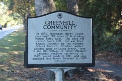
Greenhill Community / Greenhill Farming
In 1870, freedman Hardy Green purchased 30 acres of land along Mathis Ferry Road. The area was called Spark Hill, but was later named Greenhill by the Moultrie School District. Children walked several miles to Laing School, then in the Old Village of Mount Pleasant. Greenhill received electricity in 1942, paved roads in 1951, and was annexed into Mount Pleasant in 1983.
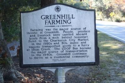
Greenhill Farming
Farming was the major source of income in Greenhill. People, produce, and livestock were carried aboard boats from a dock behind Somerset Point to the Charleston City Market. In the 1920s and ‘30s, mules and wagons transported goods to a ferry at Shem Creek. The LOOP Bus became a major source of transportation in the 1940s. Greenhill continues to thrive as a residential community.
Erected by Town of Mount Pleasant.
Topics. This historical marker is listed in this topic list: Notable Places. A significant historical year for this entry is 1870.
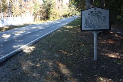
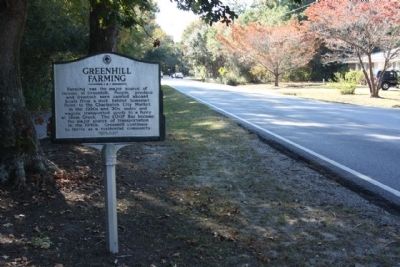
Location. 32° 48.874′ N, 79° 52.107′ W. Marker is in Mount Pleasant, South Carolina, in Charleston County. Marker is on Mathis Ferry Road near York Street, on the right when traveling north. Touch for map. Marker is in this post office area: Mount Pleasant SC 29464, United States of America. Touch for directions.
Other nearby markers. At least 8 other markers are within 2 miles of this marker , measured as the crow flies. Jacob Bond I'On (approx. 0.7 miles away); Maybank Green / Hobcaw Plantation (approx. ¾ mile away); Shipyard Road / Shelmore Boulevard (approx. ¾ mile away); Hobcaw Shipyards (approx. 0.9 miles away); Hobcaw Point Powder Magazine (approx. 0.9 miles away); I'on Cemetery (approx. one mile away); Veterans Memorial (approx. 1.1 miles away); Scanlonville (approx. 1.2 miles away). Touch for a list and map of all markers in Mount Pleasant.
Credits. This page was last revised on June 16, 2016. It was originally submitted on November 14, 2010, by Mike Stroud of Bluffton, South Carolina. This page has been viewed 581 times since then and 28 times this year. Photos: 1, 2, 3, 4. submitted on November 15, 2010, by Mike Stroud of Bluffton, South Carolina.


