Marker Logo HMdb.org THE HISTORICAL
MARKER DATABASE
“Bite-Size Bits of Local, National, and Global History”
Forkland in Greene County, Alabama — The American South (East South Central)
 

St. John’s Church

(Episcopal)


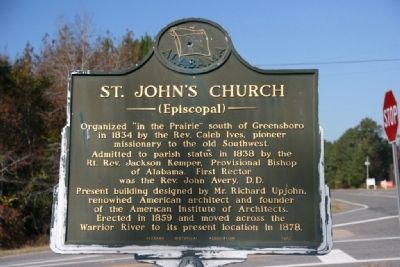
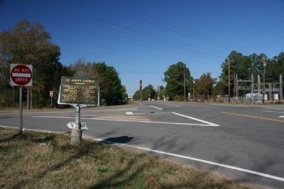
St. John’s Church Marker image. Click for full size.
Photographed By Tim & Renda Carr, November 12, 2010
1. St. John’s Church Marker
Inscription. Organized “in the Prairie” south of Greensboro in 1834 by the Rev. Caleb Ives, pioneer missionary to the old Southwest.

Admitted to parish status in 1838 by the Rt. Rev. Jackson Kemper, Provisional Bishop of Alabama. First Rector was the Rev. John Avery, D.D.

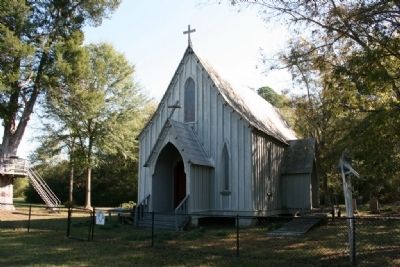
Present building designed by Mr. Richard Upjohn, renowned American architect and founder of the American Institute of Architects. Erected in 1859 and moved across the Warrior River to its present location in 1878.
 
Erected 1972 by Alabama Historical Association.
 
Topics and series. This historical marker is listed in this topic list: Churches & Religion. In addition, it is included in the Alabama Historical Association series list. A significant historical year for this entry is 1834.
 
Location. 32° 39.056′ N, 87° 52.893′ W. Marker is in Forkland, Alabama, in Greene County. Marker is at the intersection of Demopolis Highway (U.S. 43) and A. L. Isaac Road, on the right when traveling south on Demopolis Highway. Touch for map. Marker is in this post office area: Forkland AL 36740, United States of America. Touch for directions.
 
Other nearby markers. At least 8 other markers are within 10 miles of this marker, measured as the crow flies. White Bluff (approx. 9.3 miles away); Bluff Hall (approx. 9.4 miles away); Temple B’Nai Jeshurun
Paid Advertisement
Click on the ad for more information.
Please report objectionable advertising to the Editor.
Click or scan to see
this page online
(approx. 9.4 miles away); Trinity Episcopal Church (approx. 9.4 miles away); Marengo County Confederate Monument (approx. 9½ miles away); The Demopolis Opera House / Lillian Hellman And (approx. 9½ miles away); First Presbyterian Church (approx. 9½ miles away); Alabama Cattlemen’s Association (approx. 9.6 miles away).
 
St. John’s Church Marker North View Along Highway 43 image. Click for full size.
Photographed By Tim & Renda Carr, November 12, 2010
2. St. John’s Church Marker North View Along Highway 43
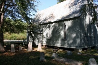
St. John’s Episcopal Church image. Click for full size.
Photographed By Tim & Renda Carr, November 12, 2010
3. St. John’s Episcopal Church
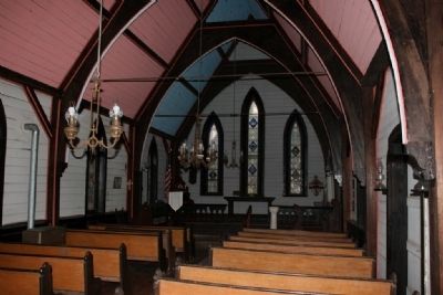
Interior View of St. John’s Episcopal Church image. Click for full size.
Photographed By Tim & Renda Carr, November 12, 2010
4. Interior View of St. John’s Episcopal Church
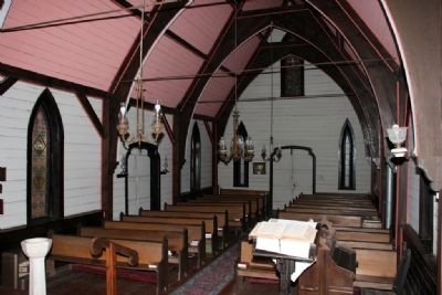
Interior View of St. John’s Episcopal Church image. Click for full size.
Photographed By Tim & Renda Carr, November 12, 2010
5. Interior View of St. John’s Episcopal Church
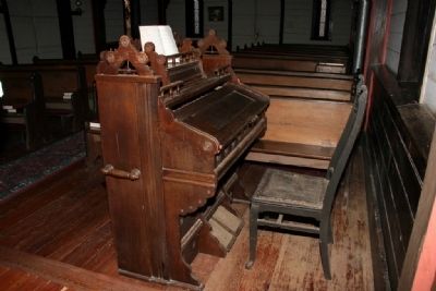
An Old Pump Organ Still Provides Music For This Church. image. Click for full size.
Photographed By Tim & Renda Carr, November 12, 2010
6. An Old Pump Organ Still Provides Music For This Church.
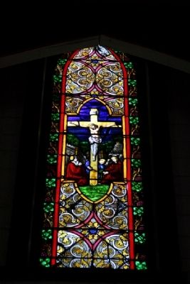
One Of The Stain Glass Windows In St. John’s Episcopal Church image. Click for full size.
Photographed By Tim & Renda Carr, November 12, 2010
7. One Of The Stain Glass Windows In St. John’s Episcopal Church
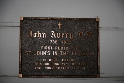
Plaque To The First Rector image. Click for full size.
Photographed By Tim & Renda Carr, November 12, 2010
8. Plaque To The First Rector
John Avery, D.D.
1788-1837
First Rector Of
St. John's In The Prairies
In Whose Memory
This Building Was Rected
And Consecrated In 1861
A Small Cemetery Located On The Side And Back Of St. John’s Church image. Click for full size.
Photographed By Tim & Renda Carr, November 12, 2010
9. A Small Cemetery Located On The Side And Back Of St. John’s Church
 
 
Credits. This page was last revised on June 16, 2016. It was originally submitted on November 14, 2010, by Timothy Carr of Birmingham, Alabama. This page has been viewed 905 times since then and 22 times this year. Photos:   1, 2, 3, 4, 5, 6, 7, 8, 9. submitted on November 14, 2010, by Timothy Carr of Birmingham, Alabama. • Bill Pfingsten was the editor who published this page.
Share this page.  
Share on Tumblr
m=37969

CeraNet Cloud Computing sponsors the Historical Marker Database.
This website earns income from purchases you make after using our links to Amazon.com. We appreciate your support.
Paid Advertisement
Apr. 19, 2024