Near Hartsville in Darlington County, South Carolina — The American South (South Atlantic)
Lower Fork Of Lynches Creek Baptist Church / Gum Branch Church
Inscription.
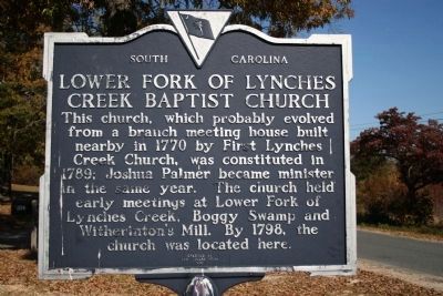
Lower Fork Of Lynches Creek Baptist Church
This church, which probably evolved from a branch meeting house built nearby in 1770 by First Lynches Creek Church, was constituted in 1789; Joshua Palmer became minister in the same year. The church held early meetings at Lower Fork of Lynches Creek, Boggy Swamp and Witherinton's Mill. By 1798, the church was located here.
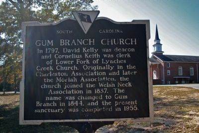
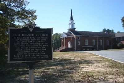
Gum Branch Church
In 1797, David Kelly was deacon and Cornelius Keith was clerk of Lower Fork of Lynches Creek Church. Originally in the Charleston Association and later the Moriah Association, the church joined the Welsh Neck Association in 1837. The name was changed to Gum Branch in 1844, and the present sanctuary was completed in 1955.
Erected 1989 by The Congregation. (Marker Number 16-17.)
Topics. This historical marker is listed in this topic list: Churches & Religion. A significant historical year for this entry is 1770.
Location. 34° 22.952′ N, 80° 11.125′ W. Marker is near Hartsville, South Carolina, in Darlington County. Marker is on Clyde Rd., on the left when traveling north. Touch for map. Marker is in this post office area: Hartsville SC 29550, United States of America. Touch for directions.
Other nearby markers. At least 8 other markers are within 7 miles of this marker, measured as the crow flies. Jacob Kelley House (approx. 3.3 miles away); Thomas E. Hart House (approx. 4.1 miles away); First Baptist Church (approx. 6.4 miles away); John L. Hart / John Hart House (approx. 6.4 miles away); Hartsville Oil Mill (approx. 6˝ miles away); Hartsville Veterans Monument (approx. 6˝ miles away); David Robert Coker 1870-1938 (approx. 6˝ miles away); James Lide Coker (approx. 6˝ miles away). Touch for a list and map of all markers in Hartsville.
Credits. This page was last revised on June 16, 2016. It was originally submitted on November 17, 2010, by David Bullard of Seneca, South Carolina. This page has been viewed 1,180 times since then and 31 times this year. Photos: 1, 2, 3. submitted on November 17, 2010, by David Bullard of Seneca, South Carolina. • Bill Pfingsten was the editor who published this page.


