Oates in Darlington County, South Carolina — The American South (South Atlantic)
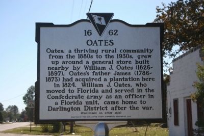
Oates
Oates, a thriving rural community from the 1880s to the 1930s, grew up around a general store built nearby by William J. Oates (1826-1897). Oates's father James (1786-1873) had acquired a plantation here in 1824. William J. Oates, who moved to Florida and served in the Confederate army in a Florida unit, came home to Darlington District after the war.
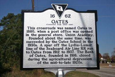
(Reverse)
This crossroads was named Oates in 1880, when a post office was opened in the general store. Union Academy, founded about the same time, was succeeded by the Oates School in the 1930s. A spur off the Lydia-Lamar line of the Seaboard Air Line RR ran to Oates from 1912 to 1937. The Bank of Oates, founded in 1916, closed during the agricultural depression of the mid-to- late 1920s.
Erected 2010 by the Darlington County Historical Commission. (Marker Number 16-62.)
Topics. This historical marker is listed in this topic list: Notable Places. A significant historical year for this entry is 1824.
Location. 34° 15.196′ N, 80° 4.657′ W. Marker is in Oates, South Carolina, in Darlington County. Marker is on Oates Highway (State Highway 403), on the left when traveling north. Touch for map. Marker is in this post office area: Lamar SC 29069, United States of America. Touch for directions.
Other nearby markers. At least 8 other markers are within 8 miles of this marker, measured as the crow flies. St. John Methodist Church / St. John Methodist Church Cemetery (approx. 0.3 miles away); Wesley Chapel (approx. 1.7 miles away); Laurie M. Lawson (approx. 1.8 miles away); Lydia Rural Fire Dept. (approx. 3 miles away); William Andrew Dowling (approx. 3.7 miles away); Battle of Mount Elon (approx. 4.3 miles away); John Wesley Methodist Church (approx. 6.3 miles away); Cash-Shannon Duel (approx. 7.2 miles away). Touch for a list and map of all markers in Oates.
Credits. This page was last revised on June 16, 2016. It was originally submitted on November 18, 2010, by David Bullard of Seneca, South Carolina. This page has been viewed 872 times since then and 60 times this year. Photos: 1, 2. submitted on November 18, 2010, by David Bullard of Seneca, South Carolina. • Craig Swain was the editor who published this page.

