High Island in Galveston County, Texas — The American South (West South Central)
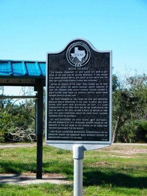
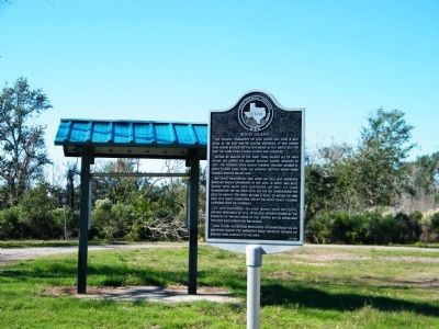
High Island
Settled by anglos in the early 1800s, nearly all of High Island lies within the Martin Dunman survey, granted in 1837. The pioneers were mostly farmers, though George E. Smith gained fame from his patented bottled water from natural springs on his land.
The town expanded in 1886 when the gulf and interstate railroad began operations in the area. A depot was built along with many new businesses. In 1897, C.T. Cade constructed the Sea View hotel on the hill overlooking the Gulf of Mexico. The hotel became a place of refuge in 1900 and 1915 when hurricanes struck the Texas coast, causing flooding over the peninsula.
Oil was discovered on High Island, with successful drilling beginning in 1916. Petroleum deposits found at the perimeter of the salt dome in 1931 started an oil boom and provided employment for the region.
High Island has become recognized internationally as an important habitat for migratory birds, bringing crowds of birdwatchers annually to the area.
Erected 1996 by Texas Historical Commission. (Marker Number 7490.)
Topics. This historical marker is listed in this topic list: Settlements & Settlers. A significant historical year for this entry is 1837.
Location. 29° 34.055′ N, 94° 23.897′ W. Marker is on High Island, Texas, in Galveston County. Marker can be reached from State Highway 124, 0.2 miles south of Guidry Road. Marker is in a rest area. Touch for map. Marker is in this post office area: High Island TX 77623, United States of America. Touch for directions.
Other nearby markers. At least 1 other marker is within walking distance of this marker. Charles Cronea (approx. 0.6 miles away).

Photographed By Richard Denney, January 24, 2010
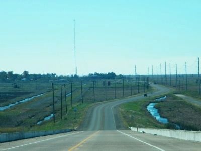
4. From High Island Towards Gulf
This photo provides a sense of the elevation above sea level that High Island affords. Photo taken on Texas 124, looking south towards Gulf of Mexico in the distance (click on photo, looks towards horizon). While it doesn't seem like it's all that "high", it was enough to keep it above the flood waters of Hurricane Ike that devastated so much of Bolivar Peninsula.
Credits. This page was last revised on October 8, 2020. It was originally submitted on December 1, 2010, by Rich Pfingsten of Forest Hill, Maryland. This page has been viewed 1,531 times since then and 122 times this year. Photos: 1, 2, 3. submitted on December 1, 2010, by Rich Pfingsten of Forest Hill, Maryland. 4. submitted on October 1, 2013, by Richard Denney of Austin, Texas. • Bill Pfingsten was the editor who published this page.


