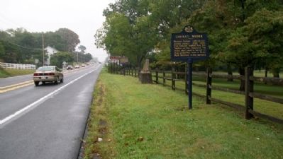
Heidelberg Township near Womelsdorf in Berks County, Pennsylvania — The American Northeast (Mid-Atlantic)
Conrad Weiser
Pioneer, Indian interpreter, treaty maker, 1732-1760. The Indians called him the "Holder of the Heavens." He lived, died, and is buried on this property, now a State Park devoted to his memory.
Erected 1947 by Pennsylvania Historical and Museum Commission.
Topics and series. This historical marker is listed in these topic lists: Colonial Era • Native Americans • Peace • Settlements & Settlers. In addition, it is included in the Pennsylvania Historical and Museum Commission series list.
Location. 40° 21.609′ N, 76° 10.323′ W. Marker is near Womelsdorf, Pennsylvania, in Berks County. It is in Heidelberg Township. Marker is on Penn Avenue/Benjamin Franklin Highway (U.S. 422), on the right when traveling east. Marker is along the northern boundary of the Conrad Weiser Homestead. Touch for map. Marker is at or near this postal address: 20 Weiser Lane, Womelsdorf PA 19567, United States of America. Touch for directions.
Other nearby markers. At least 8 other markers are within walking distance of this marker. Home and Grave of Conrad Weiser (a few steps from this marker); Tulpehocken Path (within shouting distance of this marker); Home of Conrad Weiser, 1729-1760 (about 700 feet away, measured in a direct line); Is this Weiser's House? (about 700 feet away); Womelsdorf (approx. half a mile away); Womelsdorf War Memorial (approx. half a mile away); Service Men (approx. half a mile away); Charming Forge (approx. 0.6 miles away). Touch for a list and map of all markers in Womelsdorf.
Also see . . . Conrad Weiser. (Submitted on December 6, 2010, by William Fischer, Jr. of Scranton, Pennsylvania.)
Credits. This page was last revised on February 7, 2023. It was originally submitted on December 5, 2010, by William Fischer, Jr. of Scranton, Pennsylvania. This page has been viewed 860 times since then and 19 times this year. Photos: 1, 2. submitted on December 6, 2010, by William Fischer, Jr. of Scranton, Pennsylvania.

