Kenton in Kent County, Delaware — The American Northeast (Mid-Atlantic)
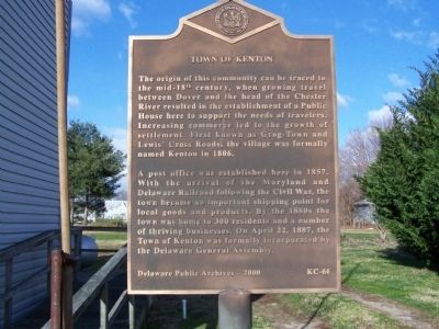
Town of Kenton
A post office was established here in 1857. With the arrival of the Maryland and Delaware Railroad following the Civil War, the town became an important shipping point for local goods and products. By the 1880s the town was home to 300 residents and a number of thriving businesses. On April 22, 1887, the Town of Kenton was formally incorporated by the Delaware General Assembly.
Erected 2000 by Delaware Public Archives. (Marker Number KC-66.)
Topics and series. This historical marker is listed in this topic list: Settlements & Settlers. In addition, it is included in the Delaware Public Archives series list. A significant historical month for this entry is April 1869.
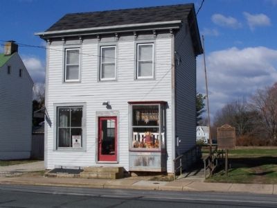
Location. 39° 13.617′ N, 75° 39.901′ W. Marker is in Kenton, Delaware, in Kent County. Marker is on Main Street close to E. Commerce Street (Delaware Route 42). Touch for map. Marker is at or near this postal address: 64 Main St, Kenton DE 19955, United States of America. Touch for directions.
Other nearby markers. At least 8 other markers are within 5 miles of this marker, measured as the crow flies. Kenton Hundred (approx. 4.2 miles away); Little Creek Hundred (approx. 4.3 miles away); a different marker also named Little Creek Hundred (approx. 4.3 miles away); Cheswold Volunteer Fire Company (approx. 4.4 miles away); Site of Blackiston Methodist Church (approx. 4.6 miles away); Cheney Clow's Rebellion (approx. 4.7 miles away); Clayton Veterans Park (approx. 4.8 miles away); Town of Clayton (approx. 4.8 miles away).
Credits. This page was last revised on March 7, 2023. It was originally submitted on December 17, 2010, by Bill Pfingsten of Bel Air, Maryland. This page has been viewed 865 times since then and 42 times this year. Photos: 1, 2. submitted on December 17, 2010, by Bill Pfingsten of Bel Air, Maryland.

