Marker Logo HMdb.org THE HISTORICAL
MARKER DATABASE
“Bite-Size Bits of Local, National, and Global History”
Allentown in Wilkinson County, Georgia — The American South (South Atlantic)
 

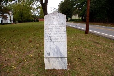
Intersection of Carolina West Florida, and Savannah Lower Creek Indian Trails


Intersection of Carolina West Florida, and Savannah Lower Creek Indian Trails Marker image. Click for full size.
Photographed By David Seibert, November 3, 2010
1. Intersection of Carolina West Florida, and Savannah Lower Creek Indian Trails Marker
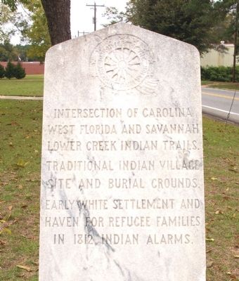
Inscription.

Traditional Indian village site and burial grounds.

Early white settlement and haven for refugee families in 1812 Indian alarms.
 
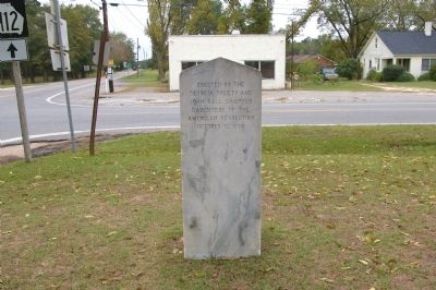
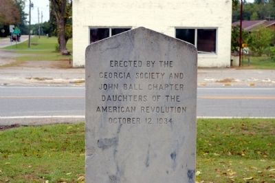
Erected 1934 by Georgia Society and John Ball Chapter Daughters of the American Revolution (DAR).
 
Topics and series. This historical marker is listed in these topic lists: Native AmericansRoads & VehiclesSettlements & SettlersWars, US Indian. In addition, it is included in the Daughters of the American Revolution series list. A significant historical year for this entry is 1812.
 
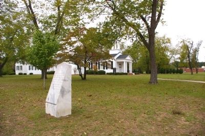
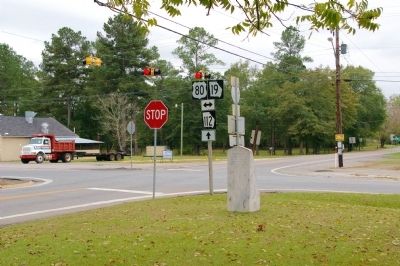
Location. 32° 35.433′ N, 83° 13.65′ W. Marker is in Allentown, Georgia, in Wilkinson County. Marker is at the intersection of U.S. 80 and Balls Ferry Road (Georgia Route 112), on the left when traveling east on U.S. 80. The marker stands on the grounds of the Allentown United Methodist Church. Touch for map. Marker is in this post office area: Allentown GA 31003, United States of America. Touch for directions.
 
Other nearby markers. At least 8 other markers are within 12 miles of this marker, measured as the crow flies. Dudley M. Hughes (approx. 1.2 miles away); Ezekiel Wimberley (approx. 9.6 miles away); Twiggs County (approx. 9.6 miles away); Twiggs County Civil War Monument (approx. 9.6 miles away); The Oconee Electric Membership Corporation
Paid Advertisement
Click on the ad for more information.
Please report objectionable advertising to the Editor.
Click or scan to see
this page online
(approx. 9.6 miles away); Richland Baptist Church (approx. 10˝ miles away); Vallombrosa Plantation of Governor George Michael Troup (approx. 10.7 miles away); Longstreet Methodist Church (approx. 11.3 miles away).
 
Intersection of Carolina West Florida, and Savannah Lower Creek Indian Trails Marker Reverse image. Click for full size.
Photographed By David Seibert, November 3, 2010
2. Intersection of Carolina West Florida, and Savannah Lower Creek Indian Trails Marker Reverse
Intersection of Carolina West Florida, and Savannah Lower Creek Indian Trails Marker image. Click for full size.
Photographed By David Seibert, November 3, 2010
3. Intersection of Carolina West Florida, and Savannah Lower Creek Indian Trails Marker
Intersection of Carolina West Florida, and Savannah Lower Creek Indian Trails Marker image. Click for full size.
Photographed By David Seibert, November 3, 2010
4. Intersection of Carolina West Florida, and Savannah Lower Creek Indian Trails Marker
Intersection of Carolina West Florida, and Savannah Lower Creek Indian Trails Marker image. Click for full size.
Photographed By David Seibert, November 3, 2010
5. Intersection of Carolina West Florida, and Savannah Lower Creek Indian Trails Marker
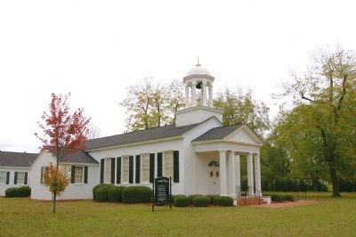
The marker with the Allentown United Methodist Church in the background.
Intersection of Carolina West Florida, and Savannah Lower Creek Indian Trails Marker image. Click for full size.
Photographed By David Seibert, November 3, 2010
6. Intersection of Carolina West Florida, and Savannah Lower Creek Indian Trails Marker
Looking south at the intersection of Georgia Highway 112 with US 80.
The Allentown United Methodist Church image. Click for full size.
Photographed By David Seibert, November 3, 2010
7. The Allentown United Methodist Church
Built in 1956
 
 
Credits. This page was last revised on May 28, 2023. It was originally submitted on December 18, 2010, by David Seibert of Sandy Springs, Georgia. This page has been viewed 1,068 times since then and 42 times this year. Photos:   1, 2, 3, 4, 5, 6, 7. submitted on December 18, 2010, by David Seibert of Sandy Springs, Georgia. • Bill Pfingsten was the editor who published this page.
Share this page.  
Share on Tumblr
m=39113

CeraNet Cloud Computing sponsors the Historical Marker Database.
This website earns income from purchases you make after using our links to Amazon.com. We appreciate your support.
Paid Advertisement
Apr. 24, 2024