Near Ontario in Vernon County, Wisconsin — The American Midwest (Great Lakes)
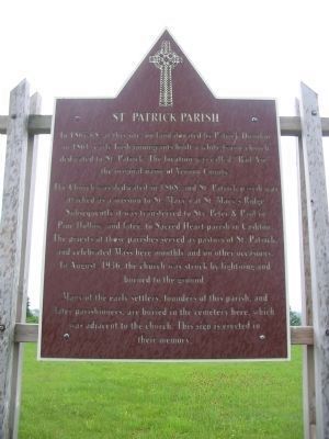
St. Patrick Parish
The Church was dedicated in 1868, and St. Patrick parish was attached as a mission to St. Mary's at St. Mary's Ridge. Subsequently it was transferred to Sts. Peter & Paul in Pine Hollow, and later, to Sacred Heart parish in Cashton. The priests at those parishes served as pastors of St. Patrick, and celebrated Mass here monthly and on other occasions. In August, 1936, the church was struck by lightning and burned to the ground.
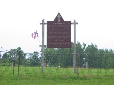
Many of the early settlers, founders of this parish, and later parishioners, are buried in the cemetery here, which was adjacent to the church. This sign is erected in their memory.
Topics. This historical marker is listed in these topic lists: Cemeteries & Burial Sites • Churches & Religion • Settlements & Settlers. A significant historical year for this entry is 1861.
Location. 43° 41.673′ N, 90° 40.807′ W. Marker is near Ontario, Wisconsin, in Vernon County. Marker is on Irish Ridge Road, half a mile west of Parker Road, on the left when traveling west. Marker is at Bad Axe Cemetery. Touch for map. Marker is in this post office area: Cashton WI 54619, United States of America. Touch for directions.
Other nearby markers. At least 7 other markers are within 15 miles of this marker, measured as the crow flies. Rockton Mill Stones (approx. 5.3 miles away); Bridge 13 (approx. 5.4 miles away); The Kickapoo River Valley (approx. 5.4 miles away); Back Breaking Work (approx. 11.7 miles away); Making the Grade (approx. 12.3 miles away); Jeremiah McLain Rusk (approx. 14.2 miles away); Donald "Deke" Slayton (approx. 14˝ miles away).
Credits. This page was last revised on June 16, 2016. It was originally submitted on December 22, 2010, by Keith L of Wisconsin Rapids, Wisconsin. This page has been viewed 556 times since then and 19 times this year. Photos: 1, 2, 3. submitted on December 22, 2010, by Keith L of Wisconsin Rapids, Wisconsin.


