Sandusky in Lynchburg, Virginia — The American South (Mid-Atlantic)
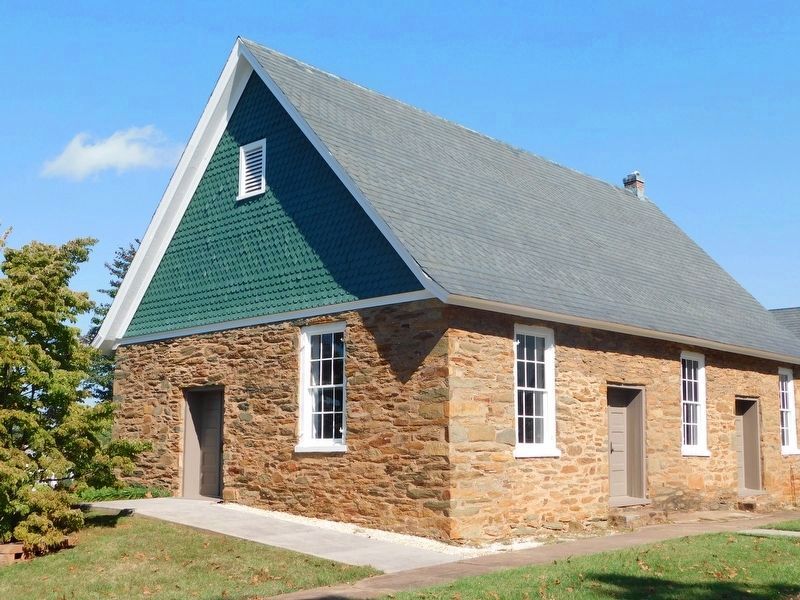
Quaker Meeting House
The Battle Begins
— Battle of Lynchburg —
Inscription.
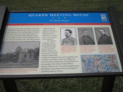
From here in June 1864, Confederate cavalrymen watched Gen. David Hunter’s Union army advance toward them on the Lynchburg-Salem Turnpike (Fort Ave). Hunter departed Lexington on June 14 and crossed the Blue Ridge Mountains near Peaks of Otter. Liberty (Bedford) fell the next day, but Confederate Gen. John McCausland’s cavalry was so successful in delaying Hunter’s army that it did not reach the ridge seen in the distance until the afternoon of June 17.
Gen. John D. Imboden’s cavalry joined McCausland to defend this high ground until Gen. Jubal A. Early’s command arrived. The dismounted troopers dug trenches for protection and used the cemetery wall to shelter the artillery. Union Gen. William W. Averell’s cavalry attacked late in the afternoon but was repulsed. Gen. George Crook’s Federal infantry followed with a successful assault, but by then Early’s corps had arrived and the Battle of Lynchburg began in earnest.
Erected by Virginia Civil War Trails.
Topics and series. This historical marker is listed in this topic list: War, US Civil. In addition, it is included in the Quakerism, and the Virginia Civil War Trails series lists. A significant historical month for this entry is June 1864.
Location. 37° 22.362′ N, 79° 11.578′ W. Marker is in Lynchburg , Virginia. It is in Sandusky. Marker is at the intersection of John Lynch Place and Fort Avenue (U.S. 460), on the left when traveling east on John Lynch Place. Touch for map. Marker is in this post office area: Lynchburg VA 24502, United States of America. Touch for directions.
Other nearby markers. At least 8 other markers are within walking distance of this marker. Grave of John Lynch (within shouting distance of this marker); 91st Ohio Volunteer Infantry (about 300 feet away, measured in a direct line); West Virginia Memorial (about 300 feet away); a different marker also named Quaker Meeting House (about 500 feet away); Sandusky (about 600 feet away); To The Memory Of The Union Soldiers (approx. half a mile away); Lynchburg (approx. half a mile away); a different marker also named Sandusky (approx. half a mile away). Touch for a list and map of all markers in Lynchburg.
More about this marker. Three portraits are on the upper right of the marker:
Gen. John Daniel Imboden commanded Confederate cavalry and fought with Gen. John C. Breckinridge at New Market in May 1864 before joining Gen. Jubal A. Early in Lynchburg. - Library of Congress
Union Gen. George Crook commanded Hunter’s Second Division at Lynchburg. Crook later replaced Hunter as commander of the Army of West Virginia following the ill-fated campaign. - Library of Congress
Union Gen. William W. Averell was unsuccessful as a cavalry commander during the Civil War. Relieved by Gen. Philip H. Sheridan in the fall of 1864, he resigned from the army to become U.S. consul to Canada. - Library of Congress
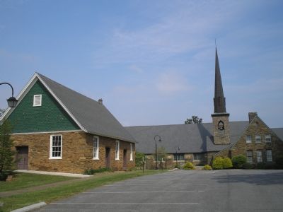
On the lower left is a photo of the "South River Meeting House. Built by Quaker settlers in 1798, it was abandoned before the Civil War. John Lynch, the city’s founder, and Confederate surgeon Dr. J.J. Terrell are buried in the cemetery."
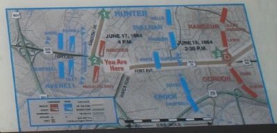
A map of showing the unit locations in the battle with respect to modern landmarks is on the lower right.
Regarding Quaker Meeting House. This is one in a series of Civil War Trails markers interpreting the Battle of Lynchburg (17-18 June 1864) and the city's role in the Civil War. Select the Civil War Virtual Tour by Marker link below to see other related markers.
Also see . . .
1. Civil War Lynchburg Virtual Tour by Markers. An eight stop Civil War Trails tour, with several Virginia state markers and other memorials added. (Submitted on December 8, 2007, by Craig Swain of Leesburg, Virginia.)
2. Battle of Lynchburg. Additional narrative of the Battle of Lynchburg. (Submitted on December 8, 2007, by Craig Swain of Leesburg, Virginia.)
Credits. This page was last revised on February 1, 2023. It was originally submitted on December 2, 2007. This page has been viewed 2,447 times since then and 16 times this year. Last updated on September 1, 2020, by Bradley Owen of Morgantown, West Virginia. Photos: 1, 2. submitted on December 2, 2007, by Bill Coughlin of Woodland Park, New Jersey. 3. submitted on April 13, 2012, by Bernard Fisher of Richmond, Virginia. 4. submitted on December 2, 2007, by Bill Coughlin of Woodland Park, New Jersey. 5. submitted on March 17, 2021, by Bradley Owen of Morgantown, West Virginia. • J. Makali Bruton was the editor who published this page.
