Harrisonburg, Virginia — The American South (Mid-Atlantic)
Woodbine Cemetery
The Soldiers’ Section
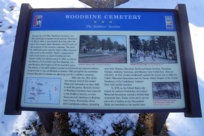
During the Civil War, Woodbine Cemetery was Harrisonburg’s principal burial ground. Chartered in March 1850, it opened later that year after the city’s first mayor, Isaac Hardesty, sold 2.5 acres of his property to the cemetery company. The need for additional grave sites for fallen soldiers became clear early in the conflict. Nearby engagements, such as the action in which Confederate Gen. Turner Ashby was killed on June 6, 1862, as well as the Battles of Cross Keys and Port Republic, created fatalities that began to fill the available space. The deaths of wounded soldiers treated at Harrisonburg’s general military hospital after it was established in October 1862 prompted city merchant Samuel Shacklett to donate an adjoining acre for a soldiers’ cemetery.
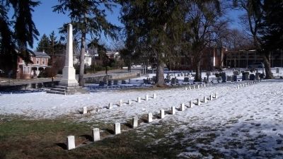
After the war, Mrs. Juliet Lyle Strayer formed the Ladies’ Memorial Association in June 1868 to tend the graves. Remains buried in Woodbine Cemetery were removed to the Soldiers’ Section, as were those interred elsewhere in Rockingham County. Eventually, about 250 Confederate soldiers, including men from Virginia, Maryland, North and South Carolina, Tennessee, Georgia, Alabama, Louisiana, and Missouri were buried here. Most are unknown. At first wooden headboards marked the raves, but in 1899, the Ladies’ Memorial Association and the Turner Ashby Chapter of the United Daughters of the Confederacy replaced them with marble markers.
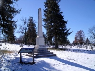
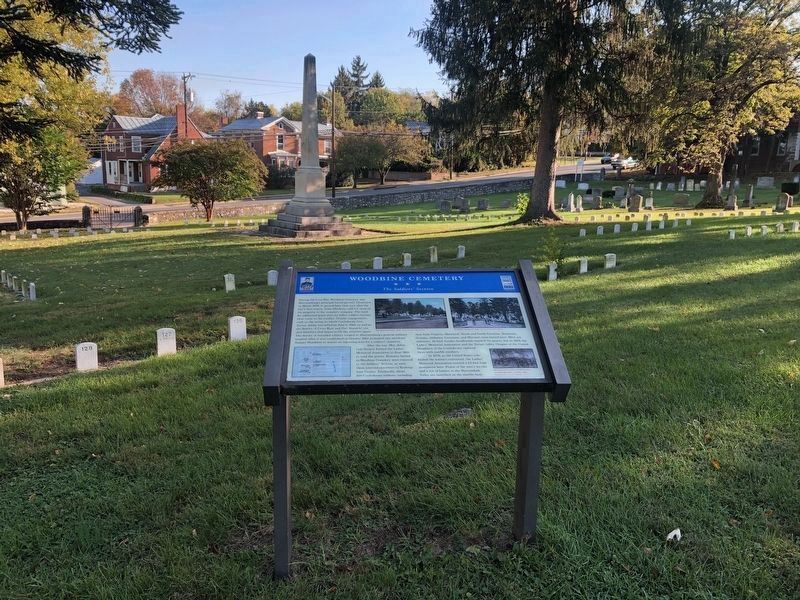
In 1876, as the United States celebrated the nation’s Centennial, the Ladies’ Memorial Association erected a 23-foot-high monument here. Praise of the men’s service and a list of battles in the Shenandoah Valley are inscribed on the marble base.
Erected 2010 by Virginia Civil War Trails and Shenandoah Valley Battlefields Foundation.
Topics and series. This historical marker is listed in these topic lists: Cemeteries & Burial Sites • War, US Civil. In addition, it is included in the United Daughters of the Confederacy, and the Virginia Civil War Trails series lists. A significant historical month for this entry is March 1850.
Location. 38° 26.892′ N, 78° 51.738′ W. Marker is in Harrisonburg, Virginia. Marker can be reached from the intersection of East Market Street (U.S. 33) and Reservoir Street. Touch for map. Marker is in this post office area: Harrisonburg VA 22801, United States of America. Touch for directions.
Other nearby markers. At least 8 other markers are within walking distance of this marker. Confederate Monument (within shouting distance of this marker); a different marker also named The Woodbine Cemetery (about 300 feet away, measured in a direct line); Anthony Hockman House (about 800 feet away); Lucy Frances Simms (approx. 0.3 miles away); Edgar Amos Love (approx. 0.4 miles away); McNeill’s Rangers (approx. 0.4 miles away); Court Square & Springhouse (approx. 0.4 miles away); Charlotte Harris Lynched (approx. 0.4 miles away). Touch for a list and map of all markers in Harrisonburg.
More about this marker. On the top are two pictures of “Woodbine Cemetery, 1920” – Courtesy Dale MacAllister
On the lower left is a "You Are Here" map of downtown Harrisonburg.
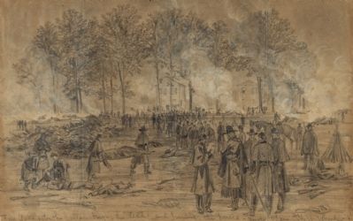
On the lower right is a sketch with the caption, “Burying dead soldiers and burning dead horses after a battle, 1862” Courtesy Library of Congress
Also see . . .
1. Civil War Trails in Harrisonburg & Rockingham County. (Submitted on December 28, 2010, by Bernard Fisher of Richmond, Virginia.)
2. Shenandoah Valley Battlefields Foundation. (Submitted on December 28, 2010, by Bernard Fisher of Richmond, Virginia.)
Credits. This page was last revised on February 2, 2023. It was originally submitted on December 28, 2010, by Bernard Fisher of Richmond, Virginia. This page has been viewed 1,926 times since then and 100 times this year. Photos: 1, 2. submitted on December 28, 2010, by Bernard Fisher of Richmond, Virginia. 3. submitted on October 18, 2020, by Devry Becker Jones of Washington, District of Columbia. 4, 5. submitted on December 28, 2010, by Bernard Fisher of Richmond, Virginia.
