Near Flippin in Monroe County, Kentucky — The American South (East South Central)
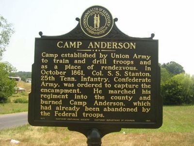
Camp Anderson
Erected 1971 by Kentucky Historical Society - Kentucky Department of Highways. (Marker Number 1391.)
Topics. This historical marker is listed in this topic list: War, US Civil. A significant historical month for this entry is October 1861.
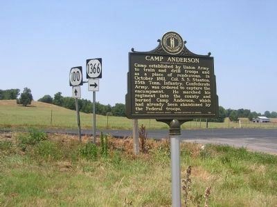
Location. 36° 42.352′ N, 85° 51.445′ W. Marker is near Flippin, Kentucky, in Monroe County. Marker is at the intersection of Fountain Run Road (State Highway 100) and County House Road (State Road 1366), on the left when traveling south on Fountain Run Road. Located at the intersection of Kentucky Routes 100 and 1366, in the community of Flippin, Kentucky. Touch for map. Marker is in this post office area: Tompkinsville KY 42167, United States of America. Touch for directions.
Other nearby markers. At least 8 other markers are within 7 miles of this marker, measured as the crow flies. Fraim Cemetery (approx. 1.2 miles away); Famous Tree / Indian Creek Church (approx. 1.3 miles away); Daniel Boone Was Here (approx. 2.6 miles away); Pikesville (approx. 2.6 miles away); Free-Town Church (approx. 3.9 miles away); Gamaliel Cemetery (approx. 5˝ miles away); Gamaliel (approx. 5˝ miles away); Fountain Run World War I & World War II Memorial (approx. 6.2 miles away). Touch for a list and map of all markers in Flippin.
More about this marker. Marker is located in the “Y” intersection of Kentucky Routes 100 and 1366.
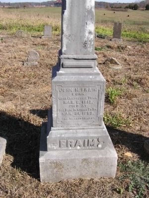
Regarding Camp Anderson. No one had more of an effect on the loyalty of Monroe County and perhaps South Central Kentucky as did John M. Fraim. John Fraim was born in Jackson (Clay) County, Tennessee in 1813. He moved to Monroe County 25 years before the war began and had obtained about 1,000 acres of land on Indian Creek near Flippin. At the outbreak of the war he owned 30 slaves but was bitterly opposed to secession. In order to help the Union cause, he went to Indiana to get 300 rifles and offered one to every person who would fight for President Lincoln. Fraim thus recruited the Ninth Kentucky Infantry and camped the men on his farm. They named the site Camp Anderson. He took his recruits to Columbia for mustering in; there he was captured by Confederate troops and taken as a prisoner to Nashville. After being interrogated he was released and on his way home was shot in the breast by guerillas. After falling to the ground one of the guerillas placed a revolver near his head to finish him off. But in the dark Fraim moved his head a little to one side and the shot missed. Feigning death, Fraim made his way to a house in Jamestown (Fountain Run) where he was carefully tended and in a few days given a Union escort to Glasgow, Kentucky by Colonel Graham. Camp Anderson was used as a rendezvous by Union forces, and as a place for drill and instruction during the early months of the war. It became a primary target for Confederate troops, and was eventually taken by Colonel S. S. Stanton who captured and burned Camp Anderson in October 1861, shortly after it had been evacuated by Union soldiers. The 9th KY Infantry would eventually take part in the Battles of Shiloh, Stones River, Chickamauga, Chattanooga and Kennesaw Mountain.
Additional keywords. John Fraim, 9th KY Infantry, Flippin, Kentucky
Credits. This page was last revised on November 17, 2023. It was originally submitted on January 1, 2011, by Chad Comer of Gamaliel, Kentucky. This page has been viewed 1,888 times since then and 77 times this year. Last updated on November 16, 2023, by C. R. Arterburn of Lexington, Kentucky. Photos: 1, 2. submitted on July 6, 2012, by Chad Comer of Gamaliel, Kentucky. 3. submitted on January 3, 2011, by Chad Comer of Gamaliel, Kentucky. • James Hulse was the editor who published this page.


