Mount Pleasant in Charleston County, South Carolina — The American South (South Atlantic)
Friendship A.M.E. Church
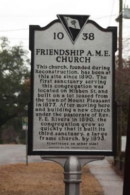
This church, founded during Reconstruction, has been at the same site since 1890. The first sanctuary serving this congregation was located on Hibben Street and built on a lot leased by the Town of Mount Pleasant in 1877. After moving here and building a new church under pastorate Rev. F.E. Rivers in 1890, the congregation grew so quickly that it built its third sanctuary, a large frame church, by 1895.
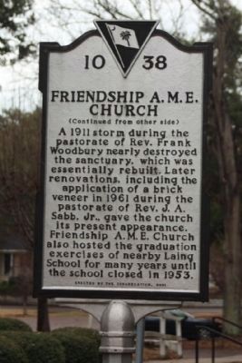
(Reverse text)
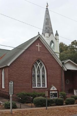
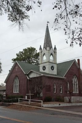
A 1911 storm during the pastorate of Rev. Frank Woodbury nearly destroyed the sanctuary,which was essentially rebuilt. Later renovations, including the application of a brick veneer in 1961 during the pastorate of Rev. J.A. Sabb, Jr. gave the church its present appearance. Friendship AME church also hosted the graduation exercises of nearby Laing School for many years until the school closed in 1953.
Erected 2001 by The Congregation. (Marker Number 10-38.)
Topics and series. This historical marker is listed in these topic lists: African Americans • Churches & Religion. In addition, it is included in the African Methodist Episcopal (AME) Church series list. A significant historical year for this entry is 1890.
Location. 32° 47.162′ N, 79° 52.391′ W. Marker is in Mount Pleasant, South Carolina, in Charleston County. Marker is on Royall Avenue, on the right when traveling north. Located between Bank and King Streets. Touch for map. Marker is at or near this postal address: 204 Royall Avenue, Mount Pleasant SC 29464, United States of America. Touch for directions.
Other nearby markers. At least 8 other markers are within walking distance of this marker. Confederate Cemetery / Memorial (within shouting distance of this marker); Laing School (within shouting distance of this marker); War of 1812 Encampment (within shouting distance of this marker); "Storm of the Century" (about 400 feet away, measured in a direct line); Darby Building (about 400 feet away); Patjens Post Office (about 500 feet away); Ronkin's Long Room / Ferry Service (about 600 feet away); The Old Village (about 600 feet away). Touch for a list and map of all markers in Mount Pleasant.
Credits. This page was last revised on June 16, 2016. It was originally submitted on January 2, 2011, by Mike Stroud of Bluffton, South Carolina. This page has been viewed 804 times since then and 16 times this year. Photos: 1, 2, 3, 4. submitted on January 6, 2011, by Mike Stroud of Bluffton, South Carolina.


