Tangier in Accomack County, Virginia — The American South (Mid-Atlantic)
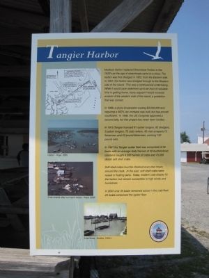
Tangier Harbor
In 1989, a stone breakwater costing $3,500,000and requiring a 400% tax increase was built, but has proved insufficient. In 1996, the US Congress approved a second jetty, but this project has never been funded.
In 1915 Tangier licensed 91 oyster tongers, 62 dredgers, 3 patent tongers, 75 crab netters, 40 crab scrapers, 13 fishermen and 43 pound fishermen, working 152 pound nets.
In 1947 the Tangier oyster fleet was comprised of 34 boats with an average daily harvest of 25 bushels/boat; crabbers caught 6,500 barrels of crabs and 15,000 dozen soft shell crabs.
Soft shell crabs must be checked every two hours around the clock. In the past, soft shell crabs were raised in floating pens. Today, modern crab shacks fill the harbor, but remain susceptible to high winds and hurricanes.
In 2007 only 35 boats remained active in the crab fleet; 20 boats comprised the oyster fleet.
Erected by Tangier History Museum & Interpretive Cultural Center.
Topics. This historical marker is listed in this topic list: Waterways & Vessels. A significant historical year for this entry is 1922.
Location. 37° 49.713′ N, 75° 59.478′ W. Marker is in Tangier, Virginia, in Accomack County. Marker can be reached from Thomas Road. Touch for map. Marker is in this post office area: Tangier VA 23440, United States of America. Touch for directions.
Other nearby markers. At least 8 other markers are within walking distance of this marker. Fort Albion (about 300 feet away, measured in a direct line); Former Site of New Testament Congregation (about 300 feet away); Welcome To Historic Tangier Island (about 300 feet away); Daley's Grocery (about 300 feet away); Chambers Lane (about 300 feet away); Ice Cream Stand (about 300 feet away); Fisherman's Corner (about 400 feet away); The Double Six (about 400 feet away). Touch for a list and map of all markers in Tangier.
Credits. This page was last revised on June 16, 2016. It was originally submitted on January 8, 2011, by Kevin W. of Stafford, Virginia. This page has been viewed 606 times since then and 56 times this year. Photo 1. submitted on January 8, 2011, by Kevin W. of Stafford, Virginia.
