Tompkinsville in Monroe County, Kentucky — The American South (East South Central)
Battle of Tompkinsville
First Kentucky Raid
— July 9, 1862 —
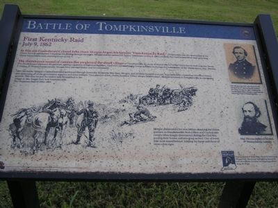
The thunderous sound of cannon fire awakened the small village of Tompkinsville. By many accounts the fall of the Union forces took only two hours. The Confederates captured the garrison, netting a quantity of logistical supplies. They also captured many Union soldiers, including the commander of the Union forces. Maj. Thomas J. Jordon, 9th Pennsylvania Cavalry. Morgan later paroled Jordan and his command.
After the battle, Morgan's raiders marched northward through Kentucky. In twenty-four days, Morgan and his men traveled over one thousand miles, capturing seventeen towns, and destroying all of the government supplies and arms in them. They paroled nearly twelve hundred Union troops. Months later, Morgan returned to Tompkinsville as a brigadier general. This time he and his raiders only bivouacked in the village as they began their next Kentucky raid; the Christmas Raid of 1862-63.
Morgan, dismounted his men before attacking the Union garrison in Tompkinsville. Both Union and Confederate cavalry often fought dismounted during the Civil War, leaving their horses and attacking on foot. One of every four men stayed behind, holding his horse and those of three other men.
(Captions of Portraits to the Right):
Col. Morgan and his command barely escaped the 9th Pennsylvania Cavalry at Celina, Tennessee. After crossing the Cumberland River, Morgan surprised the Union garrison in Tompkinsville.
Maj. Thomas Jefferson Jordon, 9th Pennsylvania Cavalry.
Erected by John Hunt Morgan Heritage Trail.
Topics and series. This historical marker is listed in this topic list: War, US Civil. In addition, it is included in the John Hunt Morgan Heritage Trail in Kentucky series list. A significant historical month for this entry is July 1777.
Location. 36° 41.94′ N, 85° 41.259′ W. Marker is in Tompkinsville, Kentucky, in Monroe County. Marker is on East 4th Street (State Highway 163), on the left when traveling south. Marker is at the entrance to the Tompkinsville Elementary School. Touch for map. Marker is in this post office area: Tompkinsville KY 42167, United States of America. Touch for directions.
Other nearby markers. At least 8 other markers are within 2 miles of this marker, measured as the crow flies. Monroe County - Tompkinsville (approx. 0.3 miles away); Courthouse Burned (approx. 0.3 miles away); Monroe County World War I Memorial (approx. 0.3 miles away); Monroe County World War II Memorial (approx. 0.3 miles away); Monroe County Korean & Vietnam War Memorial (approx. 0.3 miles away); Tompkinsville National Cemetery (approx. 0.6 miles away); Operation Iraqi Freedom Monument (approx. 1˝ miles away); Hannah Boone Pennington (approx. 1.7 miles away). Touch for a list and map of all markers in Tompkinsville.
Regarding Battle of Tompkinsville. This is stop #7 of the John Hunt Morgan Heritage Trail (Morgan's First Raid) driving tour. "Battle of Tompkinsville"
Also see . . . John Hunt Morgan Heritage Trail - Morgan's First Raid. (Submitted on January 9, 2011, by Craig Swain of Leesburg, Virginia.)
Credits. This page was last revised on June 16, 2016. It was originally submitted on January 9, 2011, by Chad Comer of Gamaliel, Kentucky. This page has been viewed 1,702 times since then and 59 times this year. Photo 1. submitted on January 1, 2011, by Chad Comer of Gamaliel, Kentucky. • Craig Swain was the editor who published this page.
