Wellsburg in Brooke County, West Virginia — The American South (Appalachia)
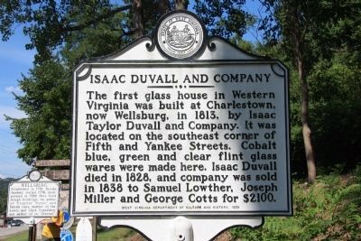
Isaac Duvall and Company
Erected 1978 by West Virginia Department of Culture and History.
Topics and series. This historical marker is listed in these topic lists: Industry & Commerce • Settlements & Settlers. In addition, it is included in the West Virginia Archives and History series list. A significant historical year for this entry is 1813.
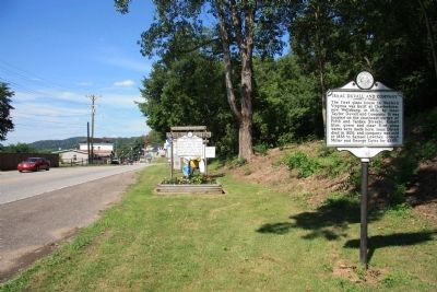
Location. 40° 15.936′ N, 80° 36.755′ W. Marker is in Wellsburg, West Virginia, in Brooke County. Marker is at the intersection of Commerce Street (West Virginia Route 2) and 3rd Street, on the right when traveling north on Commerce Street. This historical marker is located along the southern edge of town. Touch for map. Marker is in this post office area: Wellsburg WV 26070, United States of America. Touch for directions.
Other nearby markers. At least 8 other markers are within walking distance of this marker. Wellsburg (here, next to this marker); Isaac H. Duval (a few steps from this marker); 1788 Wells Log House (approx. ¼ mile away); Wellsburg Wharf (approx. ¼ mile away); Miller's Tavern (approx. ¼ mile away); Patrick Gass (approx. ¼ mile away); The Lewis and Clark Connection (approx. ¼ mile away); Wellsburg's Giant Sycamore (approx. ¼ mile away). Touch for a list and map of all markers in Wellsburg.
Credits. This page was last revised on June 16, 2016. It was originally submitted on January 10, 2011, by Dale K. Benington of Toledo, Ohio. This page has been viewed 1,105 times since then and 27 times this year. Photos: 1. submitted on January 10, 2011, by Dale K. Benington of Toledo, Ohio. 2. submitted on January 11, 2011, by Dale K. Benington of Toledo, Ohio.

