Red Wing in Goodhue County, Minnesota — The American Midwest (Upper Plains)
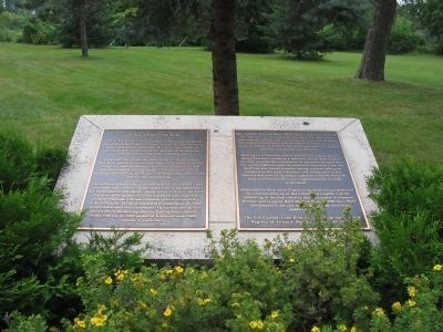
The G.A. Carlson Lime Kiln
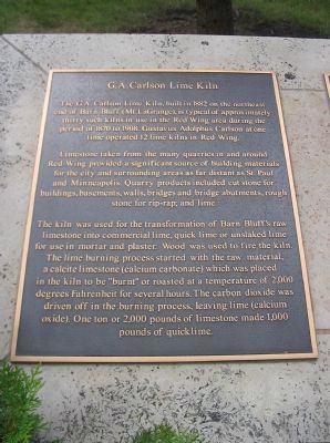
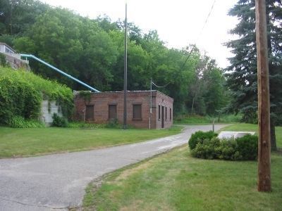
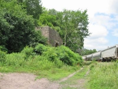
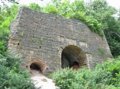
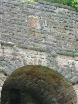
The G.A. Carlson Lime Kiln, built in 1882 on the northeast end of Barn Bluff (Mt. LaGrange), is typical of approximately thirty such kilns in use in the Red Wing area during the period from 1870 to 1908. Gustavus Adolphus Carlson at one time operated 12 lime kilns in Red Wing.
Limestone taken from the many quarries in and around Red Wing provided a significant source of building materials for the city and surrounding areas as far as St. Paul and Minneapolis. Quarry products included cut stone for buildings, basements, walls, bridges and bridge abutments, rough stone for rip-raps; and lime.
The kiln was used for the transformation of Barn Bluff's raw limestone into commercial lime, quick lime or unslaked lime for use in mortar and plaster. Wood was used to fire the kiln. The lime burning process started with the raw material, a calcite limestone (calcium carbonate) which was placed in the kiln to be "burnt" or roasted at a temperature of 2,000 degrees Fahrenheit for several hours. The carbon dioxide was driven off in the burning process, leaving lime (calcium oxide). One ton or 2,000 pounds of limestone made 1,000 pounds of quicklime.
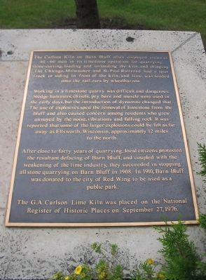
The Carlson Kiln on Barn Bluff often employed crews of 40 - 60 men in its limestone operation for quarrying, stone-cutting, loading and unloading the kiln, and shipping. The Chicago, Milwaukee and St. Paul Railroad had a spur track or siding in front of the kiln, and lime was loaded onto the rail cars by wheelbarrow.
Working in a limestone quarry was difficult and dangerous. Sledge hammers, chisels, pry bars and muscle were used in the early days, but the introduction of dynamite changed that. The use of explosives sped the removal of limestone from the bluff and also caused concern among residents who grew annoyed by the noise, vibrations and falling rock. It was reported that some of the larger explosions could be felt as far away as Ellsworth, Wisconsin, approximately 12 miles to the north.
After close to forty years of quarrying, local citizens protested the resultant defacing of Barn Bluff, and coupled with the weakening of the lime industry, they succeeded in stopping all stone quarrying on Barn Bluff in 1908. In 1910, Barn Bluff was donated to the city of Red Wing to be used as a public park.
The G.A. Carlson Lime Kiln was placed on the National Register of Historic Places on September 27, 1976.
Topics. This historical marker is listed in this topic list: Industry & Commerce. A significant historical year for this entry is 1882.
Location. 44° 34.097′ N, 92° 31.119′ W. Marker is in Red Wing, Minnesota, in Goodhue County. Marker is on East 5th Street, 0.7 miles east of Bluff Street, on the left when traveling east. Touch for map. Marker is in this post office area: Red Wing MN 55066, United States of America. Touch for directions.
Other nearby markers. At least 8 other markers are within walking distance of this marker. Barn Bluff (within shouting distance of this marker); Kiwanis Stairway (about 300 feet away, measured in a direct line); Mt. La Grange – Barn Bluff (about 300 feet away); Remember the Maine (approx. 0.3 miles away); Geology of Minnesota (approx. half a mile away); a different marker also named Kiwanis Stairway (approx. half a mile away); William Colvill (approx. 0.7 miles away); National Newspaper Association (approx. 0.9 miles away). Touch for a list and map of all markers in Red Wing.
Regarding The G.A. Carlson Lime Kiln. The Carlson's Lime Kiln is listed on the National Register of Historic Places, Structure #76001053.
Also see . . . G.A. Carlson Lime Kiln. City of Red Wing website entry (Submitted on August 4, 2022, by Larry Gertner of New York, New York.)
Credits. This page was last revised on August 4, 2022. It was originally submitted on January 15, 2011, by Keith L of Wisconsin Rapids, Wisconsin. This page has been viewed 1,982 times since then and 38 times this year. Last updated on October 24, 2021, by McGhiever of Minneapolis, Minnesota. Photos: 1, 2, 3, 4. submitted on January 15, 2011, by Keith L of Wisconsin Rapids, Wisconsin. 5, 6, 7. submitted on July 29, 2011, by Keith L of Wisconsin Rapids, Wisconsin. • J. Makali Bruton was the editor who published this page.
