Pintlala in Montgomery County, Alabama — The American South (East South Central)
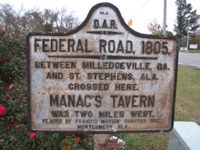
Federal Road, 1805,
Inscription.
between Milledgeville, Ga.
and St. Stephens, Ala.
crossed here.
Manac's Tavern
was two miles west.
Erected 1932 by Daughters of the American Revolution, Francis Marion Chapter, Montgomery Ala. (Marker Number 5.)
Topics and series. This historical marker is listed in these topic lists: Roads & Vehicles • Settlements & Settlers. In addition, it is included in the Daughters of the American Revolution series list. A significant historical year for this entry is 1805.
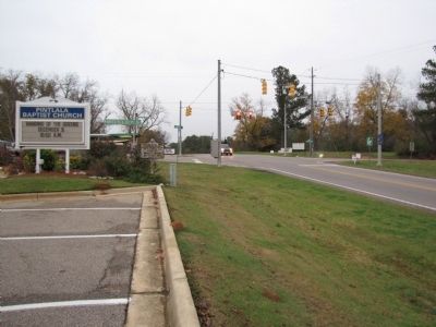
Location. 32° 10.543′ N, 86° 22.045′ W. Marker is in Pintlala, Alabama, in Montgomery County. Marker is at the intersection of Mobile Highway (U.S. 31) and Federal Road / West Old Hayneville Road (County Road 24), on the left when traveling north on Mobile Highway. Located adjacent to the Pintlala Baptist Church's marquee sign. Touch for map. Marker is in this post office area: Hope Hull AL 36043, United States of America. Touch for directions.
Other nearby markers. At least 8 other markers are within 8 miles of this marker, measured as the crow flies. Pintlala Grange Hall / Grange Hall School (about 700 feet away, measured in a direct line); Pintlala School (approx. ¼ mile away); The Bethel Cemetery (approx. ¾ mile away); The Federal Road / Manac's Tavern (approx. 1.1 miles away); Tankersley Rosenwald School (approx. 2.4 miles away); Abner McGehee / Early Alabama Entrepreneur (approx. 5.7 miles away); Teague Road (approx. 7.1 miles away); Lynching in America / Lynching in Letohatchee (approx. 7.7 miles away). Touch for a list and map of all markers in Pintlala.
Also see . . .
1. The Old Federal Road. Rootsweb website entry (Submitted on January 17, 2011, by Lee Hattabaugh of Capshaw, Alabama.)
2. Federal Road. New Georgia Encyclopedia website entry (Submitted on January 17, 2011, by Lee Hattabaugh of Capshaw, Alabama.)
Credits. This page was last revised on September 29, 2021. It was originally submitted on January 17, 2011, by Lee Hattabaugh of Capshaw, Alabama. This page has been viewed 1,512 times since then and 55 times this year. Photos: 1. submitted on September 20, 2016, by Mark Hilton of Montgomery, Alabama. 2, 3. submitted on January 17, 2011, by Lee Hattabaugh of Capshaw, Alabama. • Syd Whittle was the editor who published this page.


