Near West Mansfield in Union County, Ohio — The American Midwest (Great Lakes)
Greenville Treaty Line / Indian Boundary
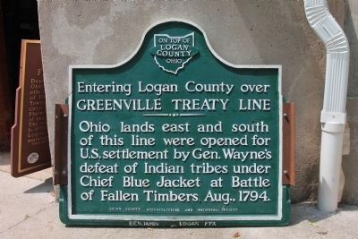
Greenville Treaty Line
——— • ———
Ohio lands east and south
of this line were opened for
U.S. settlement by Gen. Wayne’s
defeat of Indian tribes under
Chief Blue Jacket at the Battle
of Fallen Timbers, August 1794.
[Reverse Side of Marker]:
——— • ———
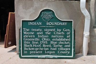
The treaty signed by Gen.
Wayne and the Chiefs of
eleven Indian nations at
Greenville, Ohio, established
this line in 1795. Blue Jacket,
Black Hoof, Reed, Tarhee and
Bu-kon-ge-he-las had villages
in present Logan County.
Topics. This historical marker is listed in these topic lists: Native Americans • Wars, US Indian. A significant historical year for this entry is 1794.
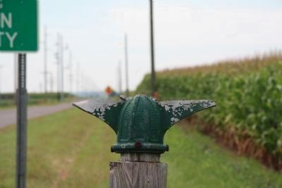
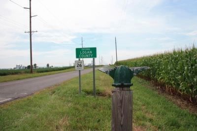
Location. Marker is missing. It was located near 40° 26.202′ N, 83° 31.699′ W. Marker was near West Mansfield, Ohio, in Union County. Marker was on Treaty Line Road (County Route 26) east of West Mansfield - Mount Victory Road (County Route 124). What is left of this historical marker is located on the north side of Treaty Line Road, just east of the Logan County-Union County Line, in Union County. Touch for map. Marker was in this post office area: West Mansfield OH 43358, United States of America. Touch for directions.
Other nearby markers. At least 8 other markers are within 7 miles of this location, measured as the crow flies. Flatwood Schoolhouse (approx. 2.4 miles away); West Mansfield (approx. 2.4 miles away); a different marker also named West Mansfield (approx. 2˝ miles away); Greeneville Treaty Line / Greeneville Treaty Line in Union County (approx. 2.6 miles away); Byhalia School Veterans Memorial (approx. 3.9 miles away); York Township Veterans Memorial (approx. 4.3 miles away); York Center WW II Veterans Memorial (approx. 4.3 miles away); Hale Township Veterans Memorial (approx. 6.6 miles away). Touch for a list and map of all markers in West Mansfield.
More about this marker. The Treaty Line Road gets its name from the fact that it runs along the old Greenville Treaty Line. This treaty was the end result of the victory of the American military forces led by General Anthony Wayne against the confederation of Native American tribes that had unified in their resistance against American settlement of the Northwest Territory in the early 1790s. The treaty line marked the northern extent of Native American lands that had been ceded to American settlement.
Additional commentary.
1. Greenville Treaty Line / Indian Boundary marker
On August 3, 2012, while visiting the Logan County Historical Museum in Bellefontaine, Ohio, I learned that the Greenville Treaty Line / Indian Boundary marker is currently in storage in the basement of the Logan County Historical Museum, awaiting repairs and eventual remounting.
— Submitted August 25, 2012, by Dale K. Benington of Toledo, Ohio.
Credits. This page was last revised on June 16, 2016. It was originally submitted on January 23, 2011, by Dale K. Benington of Toledo, Ohio. This page has been viewed 1,537 times since then and 20 times this year. Photos: 1. submitted on January 23, 2011. 2, 3. submitted on January 23, 2011, by Dale K. Benington of Toledo, Ohio. 4, 5. submitted on August 25, 2012, by Dale K. Benington of Toledo, Ohio. • Kevin W. was the editor who published this page.


