Bonnieville in Hart County, Kentucky — The American South (East South Central)
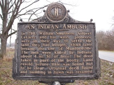
An Indian Ambush
Erected 1969 by Kentucky Historical Society / Kentucky Department of Highways. (Marker Number 1299.)
Topics and series. This historical marker is listed in these topic lists: Exploration • Native Americans • Settlements & Settlers. In addition, it is included in the Kentucky Historical Society series list. A significant historical year for this entry is 1788.
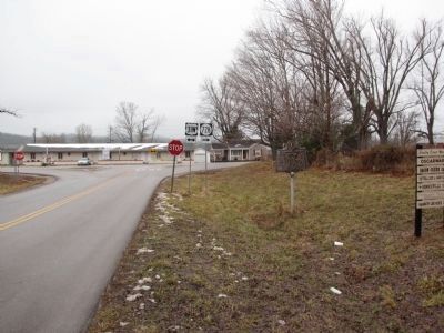
Location. 37° 22.721′ N, 85° 54.152′ W. Marker is in Bonnieville, Kentucky, in Hart County. Marker is on Bacon Creek Road (State Highway 728) east of North Dixie Highway (U.S. 31W), on the left when traveling east. Touch for map. Marker is at or near this postal address: 7597 North Dixie Highway, Bonnieville KY 42713, United States of America. Touch for directions.
Other nearby markers. At least 8 other markers are within 8 miles of this marker, measured as the crow flies. Bacon Creek Trestle (approx. ¼ mile away); Bacon Creek Bridge (approx. ¼ mile away); a different marker also named Bacon Creek Bridge (approx. ¼ mile away); On Washington's Guard (approx. 6.3 miles away); John Ireland (approx. 7.4 miles away); John Muir & Robert Munford (approx. 7.4 miles away); William Clark and Family (approx. 7.4 miles away); Albery Allson Whitman (approx. 7.4 miles away). Touch for a list and map of all markers in Bonnieville.
Credits. This page was last revised on October 30, 2020. It was originally submitted on January 28, 2011, by Lee Hattabaugh of Capshaw, Alabama. This page has been viewed 1,387 times since then and 82 times this year. Photos: 1, 2. submitted on January 28, 2011, by Lee Hattabaugh of Capshaw, Alabama. • Syd Whittle was the editor who published this page.

