Stafford in Stafford County, Virginia — The American South (Mid-Atlantic)
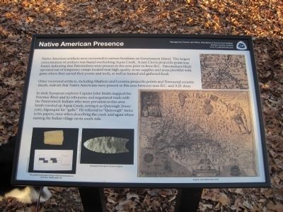
Native American Presence
Other recovered artifacts, including Madison and Levanna projectile points and Townsend ceramic shards, indicate that Native Americans were present in this area between 1200 B.C. and A.D. 1600.
In 1608, European explorer Captain John Smith mapped the Potomac River and its tributaries and negotiated trade with the Patawomeck Indians who were prevalent in this area. Smith traveled up Aquia Creek, noting it as Quiyough (kwee' yuh), Algonquin for "Gulls." He referred to "Quiyough" twice in his papers, once when describing the creek and again when naming the Indian village on its south side.
Erected 2010 by Tourism and Parks, Recreation & Community Facilities, Stafford County, Virginia.
Topics. This historical marker is listed in this topic list: Native Americans.
Location. 38° 26.926′ N, 77° 22.798′ W. Marker is in Stafford, Virginia, in Stafford County. Marker can be reached from Coal Landing Road (County Road 631). Touch for map. Marker is in this post office area: Stafford VA 22554, United States of America. Touch for directions.
Other nearby markers. At least 8 other markers are within 2 miles of this marker, measured as the crow flies. Site Selection / Architectural Features (about 400 feet away, measured in a direct line); Transporting the Stone (about 500 feet away); Quarrying the Stone (about 500 feet away); Island Ownership (about 600 feet away); Government Island (approx. half a mile away); a different marker also named Government Island (approx. half a mile away); Mary Kittamaquund (approx. 1.2 miles away); Peyton’s Ordinary (approx. 1.3 miles away). Touch for a list and map of all markers in Stafford.
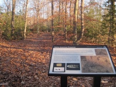
More about this marker. Two small pictures in the lower left of this marker are of partial and complete Clovis points found in Virginia. The partial Clovis point was found on Government Island, and is more than 10,000 years old.
Also on the marker is a photograph of Captain John Smith's map of 1610, featuring the Indian village of Quiyough.
Credits. This page was last revised on June 16, 2016. It was originally submitted on January 28, 2011, by Kevin W. of Stafford, Virginia. This page has been viewed 959 times since then and 74 times this year. Photos: 1, 2, 3. submitted on January 28, 2011, by Kevin W. of Stafford, Virginia.


