Near Munfordville in Hart County, Kentucky — The American South (East South Central)
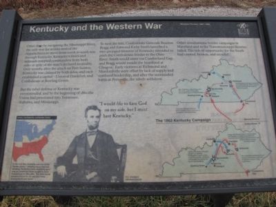
Kentucky and the Western War
Western Theater, 1861-1862
But the rebel defense of Kentucky was overextended, and by the beginning of 1862 the Union had penetrated into Tennessee, Alabama, and Mississippi.
To turn the tide, Confederate Generals Braxton Bragg and Edmund Kirby Smith launched a two-pronged invasion of Kentucky intended to push the Confederate border to the Ohio River. Smith would enter via Cumberland Gap, and Bragg would invade the heartland at Glasgow. Early victories at Richmond and Munfordville were offset by lack of supply and confused leadership, and after the unintended battle at Perryville, the rebels withdrew.
Other simultaneous border campaigns in Maryland and in the Transmississippi likewise failed. The tide of opportunity for the South had crested, broken, and receded.
Erected by Battle for the Bridge Historic Preserve.
Topics. This historical marker is listed in these topic lists: Government & Politics • War, US Civil. A significant historical year for this entry is 1862.
Location. 37° 15.43′ N, 85° 53.28′ W. Marker is near Munfordville, Kentucky, in Hart County. Marker is on Charlie Downing Road north of Bragg Avenue, on the left when traveling north. Touch for map. Marker is in this post office area: Munfordville KY 42765, United States of America. Touch for directions.
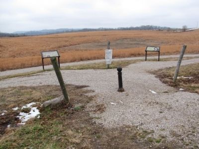
Other nearby markers. At least 8 other markers are within walking distance of this marker. The Raider (here, next to this marker); Anthony Woodson Farm (within shouting distance of this marker); The Woodson Farm (about 300 feet away, measured in a direct line); Battle of Munfordville: Day 1 (about 400 feet away); Fort Craig (about 800 feet away); Battle of Munfordville: Siege (approx. 0.2 miles away); L&N Railroad Bridge (approx. 0.2 miles away); Battle of Munfordville (approx. ¼ mile away). Touch for a list and map of all markers in Munfordville.
Credits. This page was last revised on June 16, 2016. It was originally submitted on February 2, 2011, by Lee Hattabaugh of Capshaw, Alabama. This page has been viewed 949 times since then and 18 times this year. Photos: 1, 2. submitted on February 2, 2011, by Lee Hattabaugh of Capshaw, Alabama. • Craig Swain was the editor who published this page.

