Near Abbeville in Wilcox County, Georgia — The American South (South Atlantic)
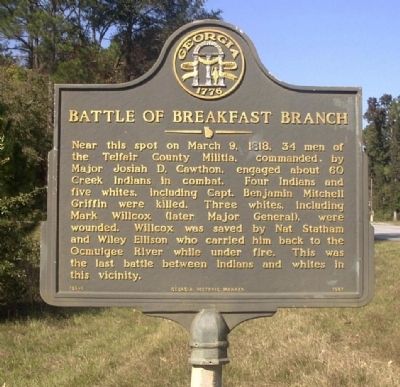
Battle of Breakfast Branch
Erected 1987 by Georgia Department of Natural Resources. (Marker Number 156-5.)
Topics and series. This historical marker is listed in these topic lists: Native Americans • Wars, US Indian. In addition, it is included in the Georgia Historical Society series list. A significant historical month for this entry is March 1826.
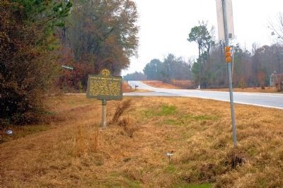
Location. 31° 56.284′ N, 83° 16.409′ W. Marker is near Abbeville, Georgia, in Wilcox County. Marker is at the intersection of U.S. 129 and American Legion Road (County Route 70), on the right when traveling south on U.S. 129. Touch for map. Marker is in this post office area: Abbeville GA 31001, United States of America. Touch for directions.
Other nearby markers. At least 8 other markers are within 7 miles of this marker, measured as the crow flies. New Hope Primitive Baptist Church (approx. 2.2 miles away); Jefferson Davis Camp Site (approx. 4.2 miles away); De Soto Trail (approx. 4.2 miles away); Jefferson Davis (approx. 4.2 miles away); a different marker also named Jefferson Davis (approx. 4.2 miles away); Wilcox County (approx. 4.3 miles away); Wilcox County Confederate Monument (approx. 4.3 miles away); Ozias Church Bethlehem Church (approx. 6.8 miles away). Touch for a list and map of all markers in Abbeville.
Credits. This page was last revised on January 17, 2021. It was originally submitted on August 28, 2008, by David Seibert of Sandy Springs, Georgia. This page has been viewed 2,508 times since then and 75 times this year. Last updated on January 17, 2021, by Bradley Owen of Morgantown, West Virginia. Photos: 1. submitted on August 28, 2008, by David Seibert of Sandy Springs, Georgia. 2. submitted on February 5, 2011, by David Seibert of Sandy Springs, Georgia. • J. Makali Bruton was the editor who published this page.

